Jeff tells about cactus fruits we encountered hiking:
The video cuts off early. The second half of the story is that Jeff’s second attempt at eating these involved picking a bunch and using his pocket knife to scrape off the thorns as he walked. Great idea! Unfortunately, that meant that the thorns fell down and onto his upper legs as he hiked. He was a little jumpy that evening…
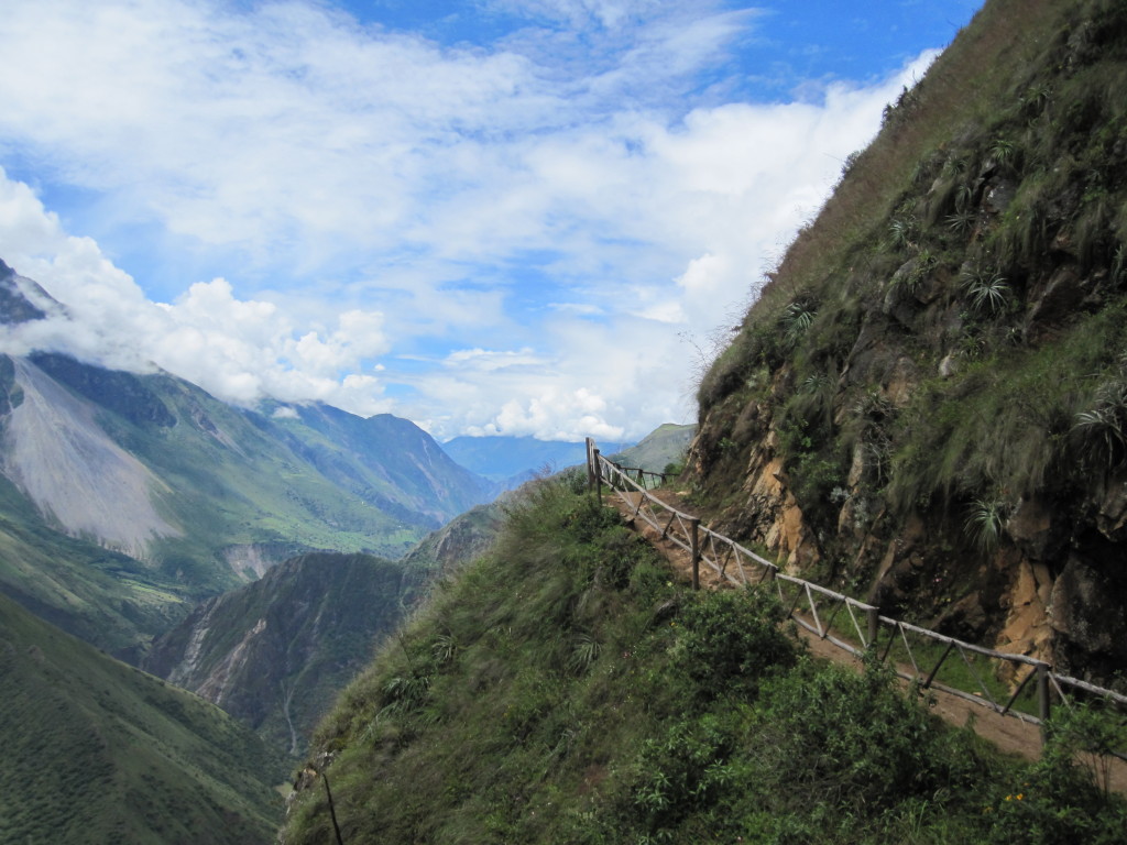
From Cusco, we started off on our trek through the Andes. The most popular trek around here is the Inca trail to Machu Picchu. This trail is famous and therefore very busy – they limit the number of people on the trail to 500 per day and require everyone to have a guide (and porters too, I believe). Since we had no desire to share a trail with 498 other people and didn’t really care to be guided, I went searching for alternatives.
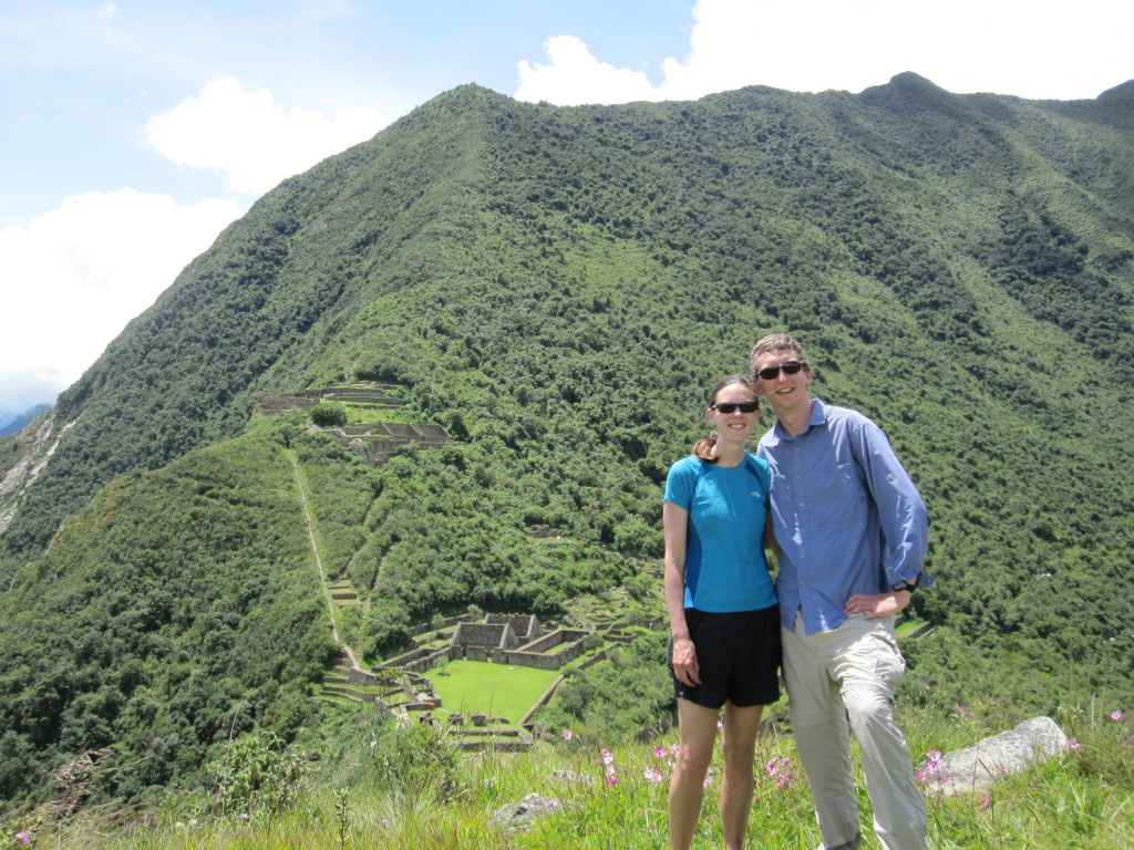
The trail we settled on went from a town called Cachora, a few hours from Cusco by bus, to the Inca ruins of Choquequirao (ask Jeff to pronounce that for you – he still can’t quite say it). From Choquequirao we had the option of continuing on to Machu Picchu or returning to Cachora. Our extra time acclimating in Cusco had cut down on our time for the trek, so we weren’t sure if we’d be able to make it all the way to MP. We had a trip description from some people who had done the trek in 5 days, so our goal was to see if we could match what they did.
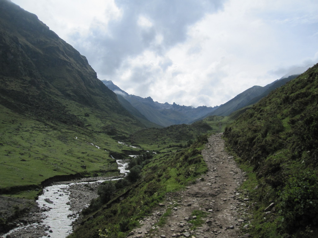
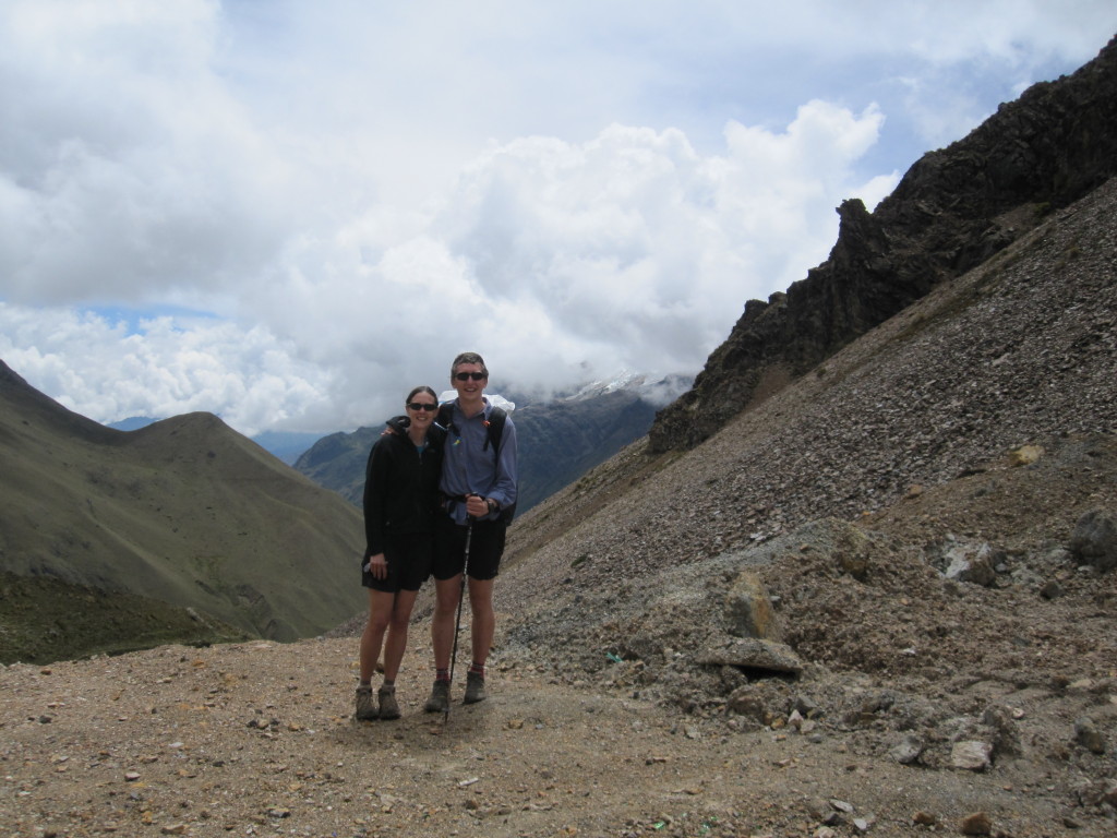
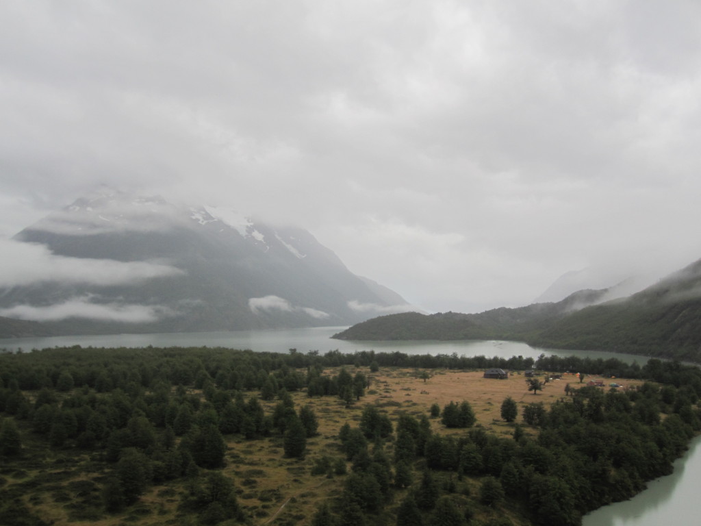
What we didn’t really know going into this was that hiking through the Andes involves huge amounts of up and down through high elevation. Over five days, we climbed and descended more than 20,000 feet and climbed a pass every day. One day we climbed over 7,000 feet and went over a pass around 14,000 feet, and the day after we topped a pass at 15,500 feet, the highest either of us had ever been. The mileage was only about 60 miles total, but was the hardest backpacking trip I’ve ever done. We would get up with the sun every day and hike until dark.
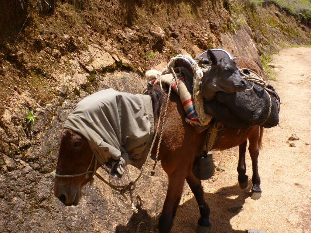
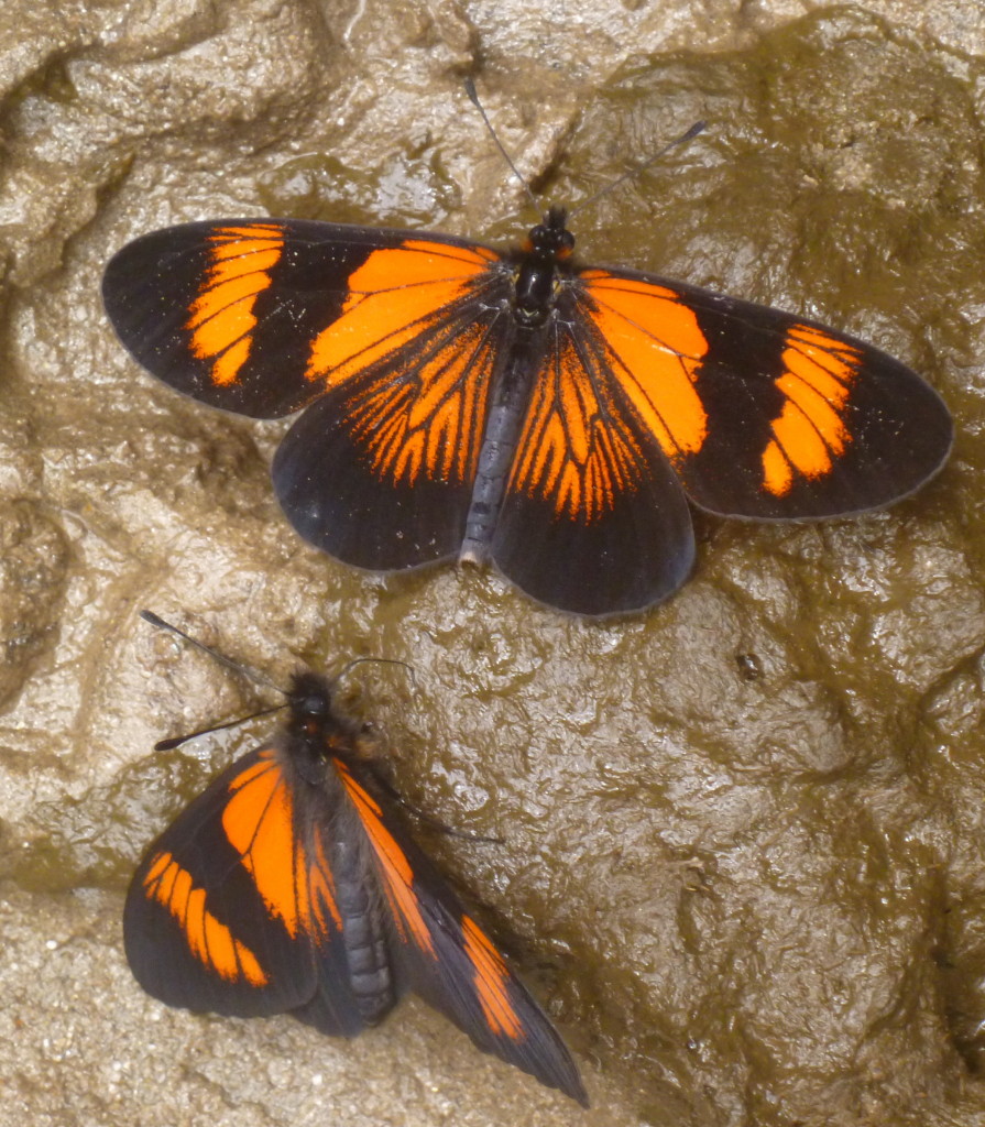
A farmer was herding a mother cow up the trail (with much difficulty). Look at the side of this mule(?) and you’ll see the calf. We saw cattle in some incredible places.
I was still recovering from a cold when we started hiking, and the stress on my body made the cold worse again for several days. I also picked up mild food poisoning for the last couple days, just as we were climbing to our highest pass. These didn’t help make hiking any easier.
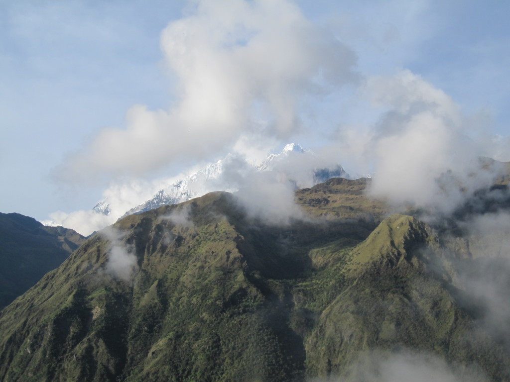
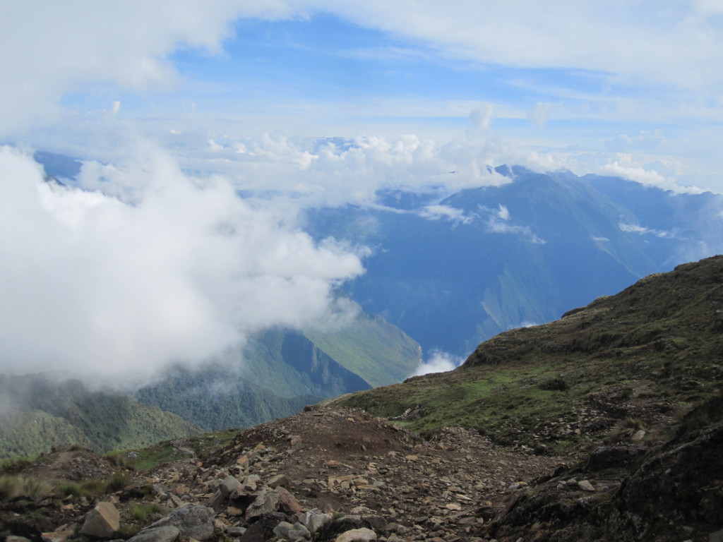
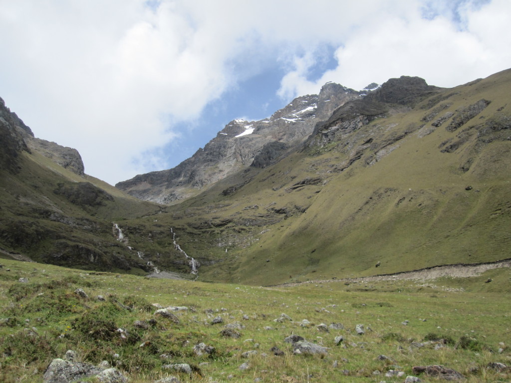
Though hard, the trek was also amazing. The scenery in the Andes was spectacular, and since we were at the end of the wet season, everything was super green. It was interesting to go through all the different climactic zones from rainforest to alpine. As high as we got, there was still plenty of mountains higher than we were. As we crested the 14,000 foot pass, we saw a mountain ahead that was waaaay higher than we were. We think it must have been around 20,000 feet high. Because it was still in the wet season, most of the high mountains were covered by clouds most of the time, so we only got a few good views of the really high mountains.
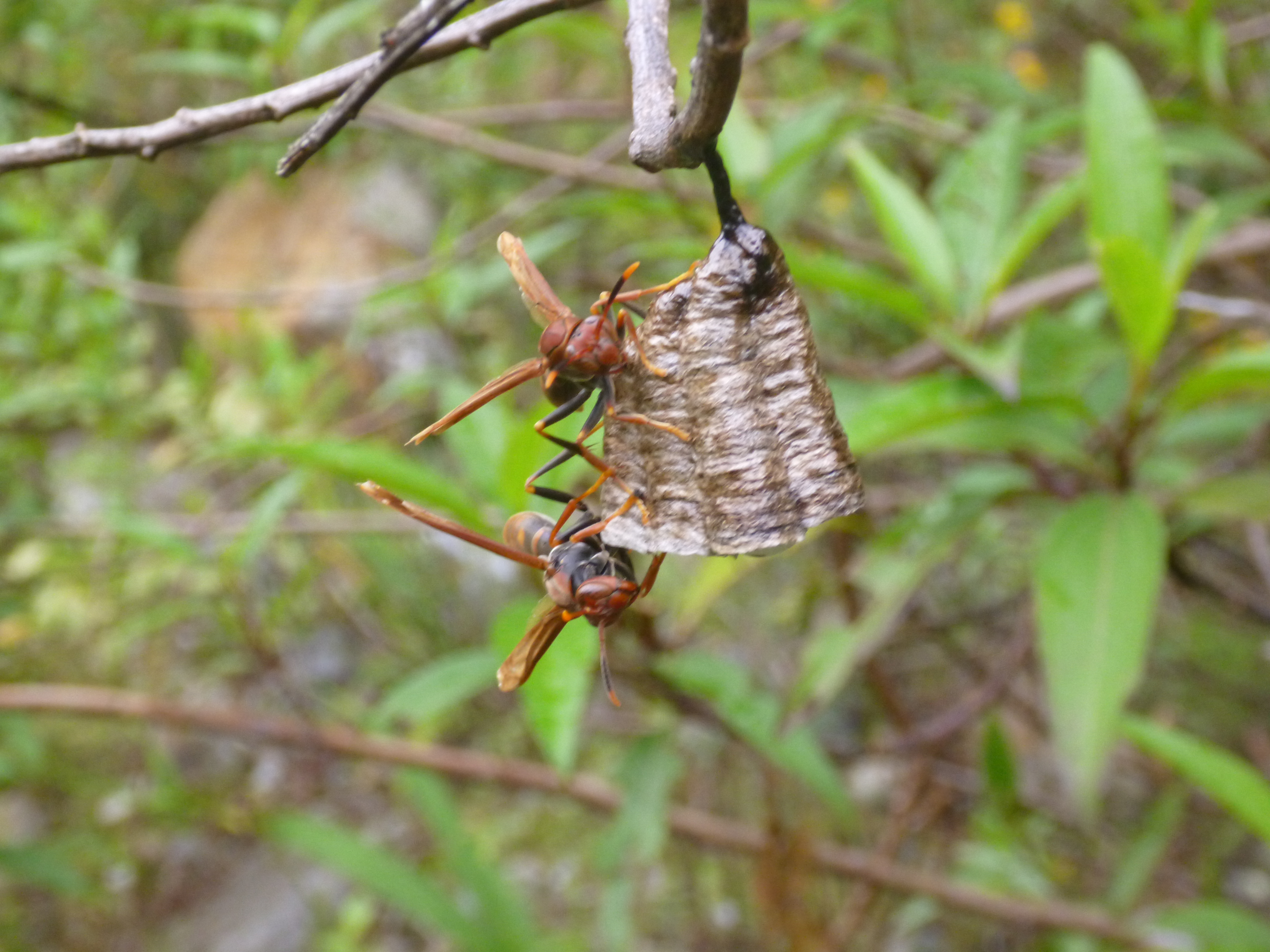
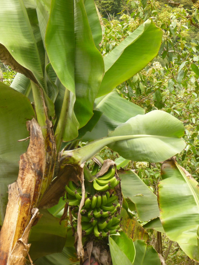
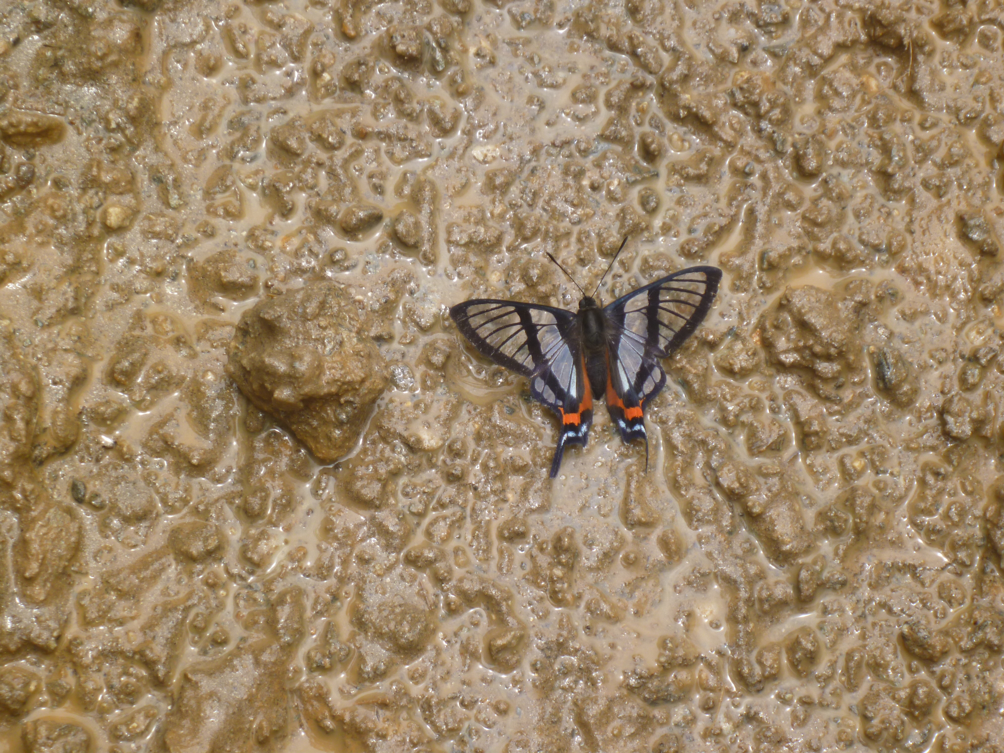
Wild and plant life:
Saguaro Cactus
bananas
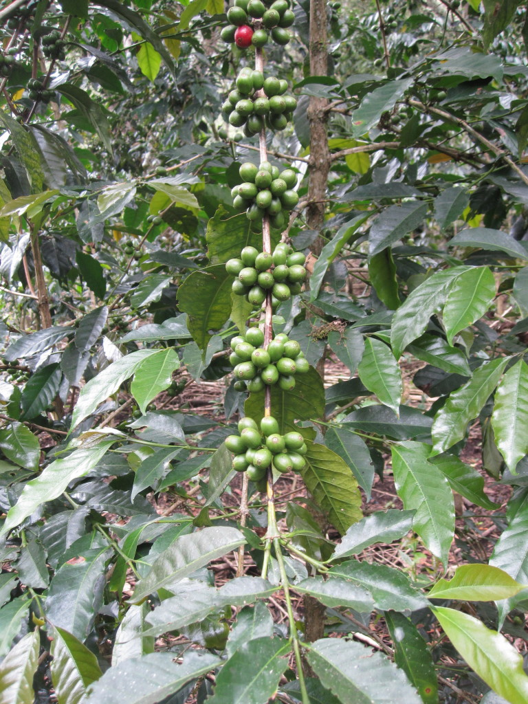
Coffee berries
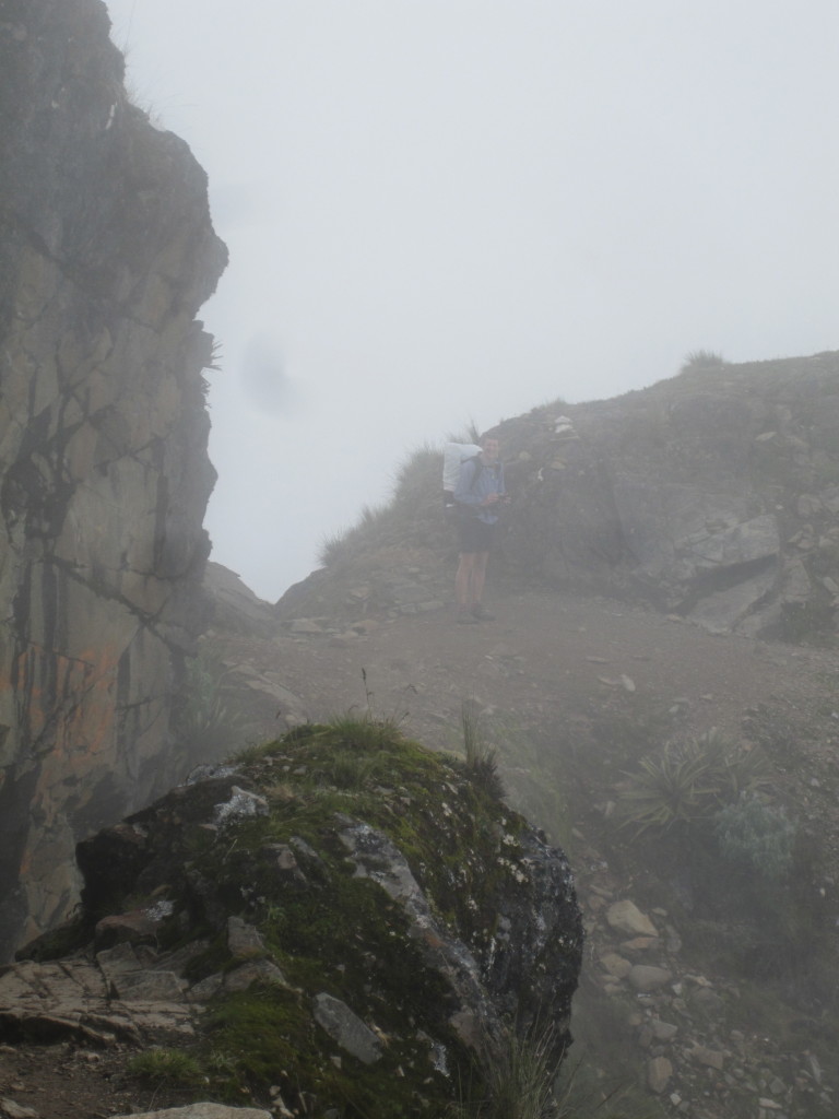
Fog at 14,000 feet
Really high mountains:
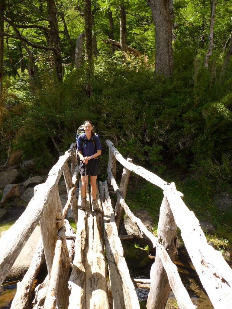
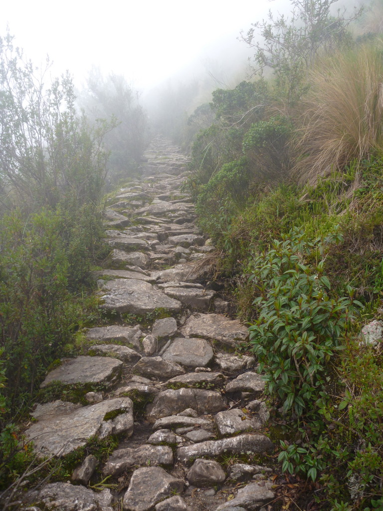
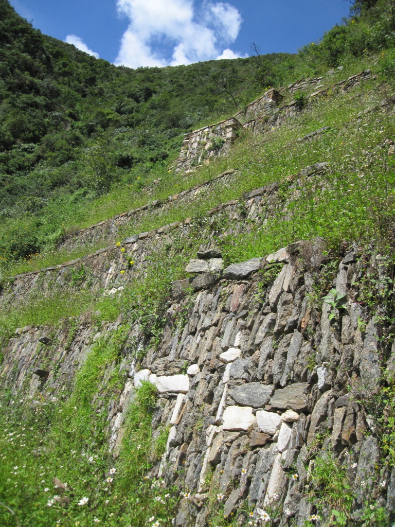
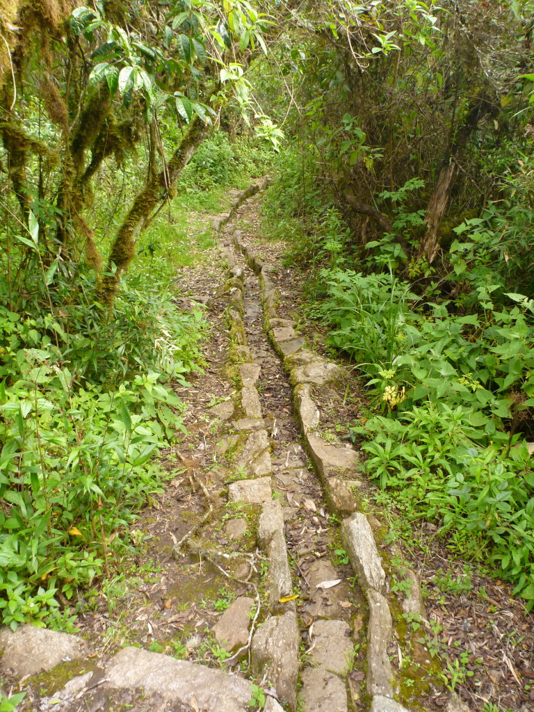
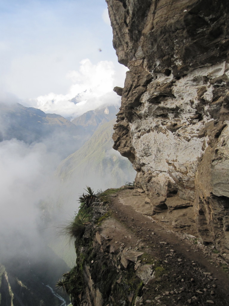
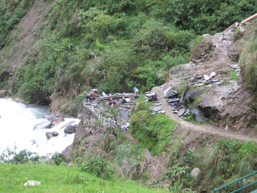
We has the hike mostly to ourselves as far as non-native people go. We saw about 6 white folks on our way to Choquequirao, and none at all for the next three days until we intersected with another popular trek. Not that we didn’t see anyone – we passed several small towns and homesteads along the way, and there were local people working on the trail in a few sections as well (who always managed to ask us for a donation, despite already being paid). We decided that the Peruvian trail maintenance happening was actually making the trail a good bit worse in the long run, as they were just taking out rocks and not adding any water channels. A few good rains, and that trail would be a river. I hope they do a better job on the more popular routes. In contrast, the sections of old Inca-made trail we encountered were amazingly well done and well preserved.
Trail made by Incas
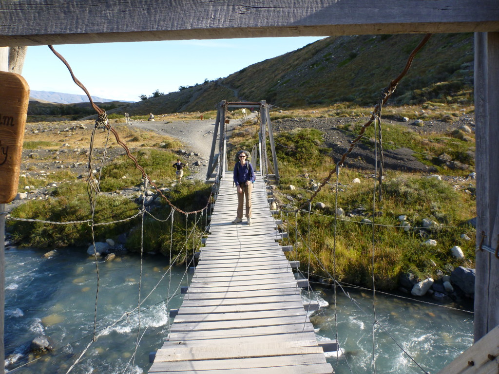
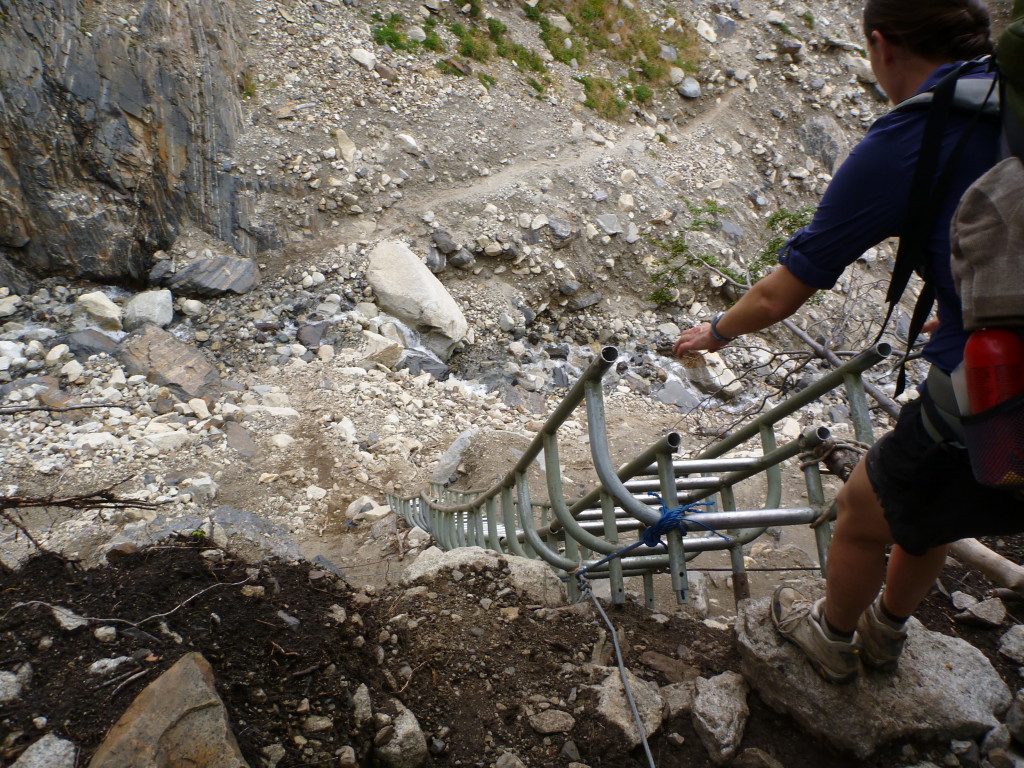
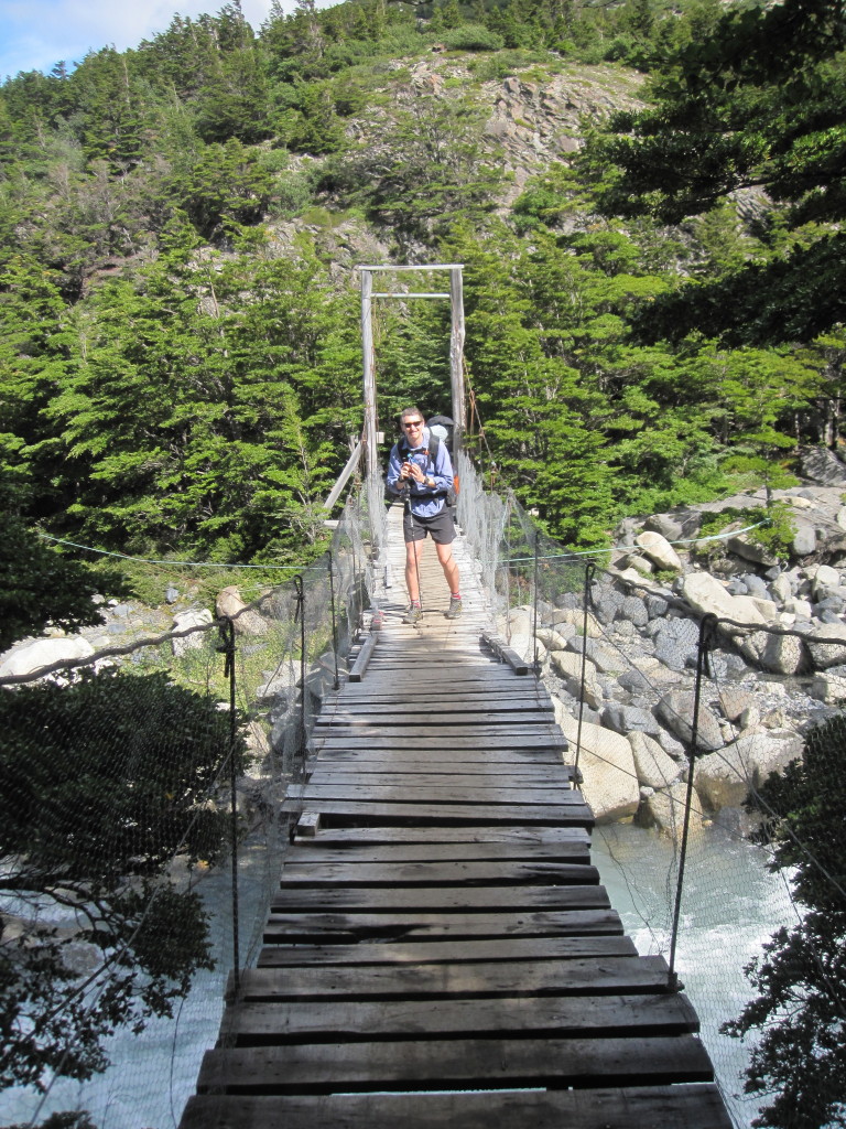
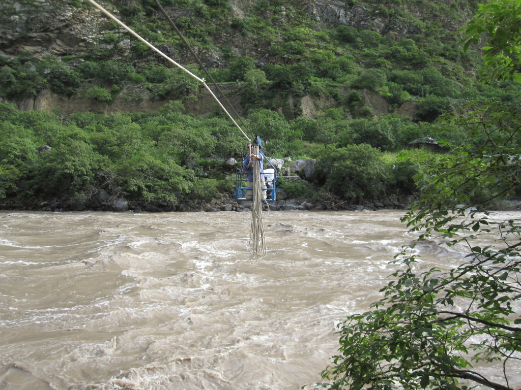
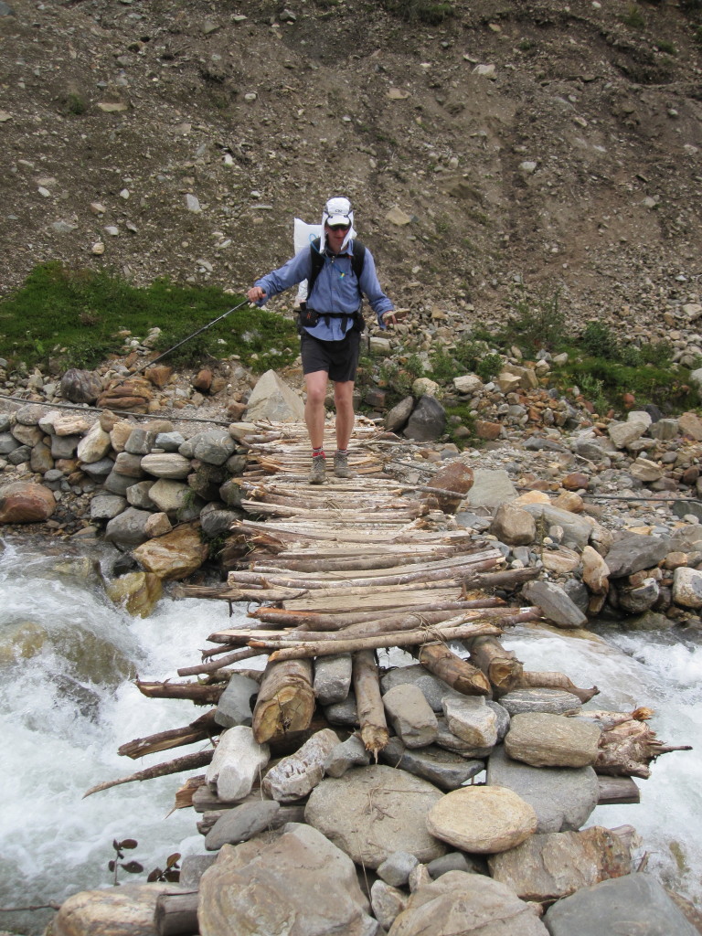
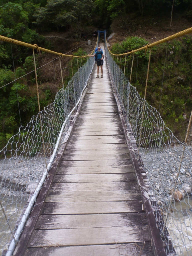
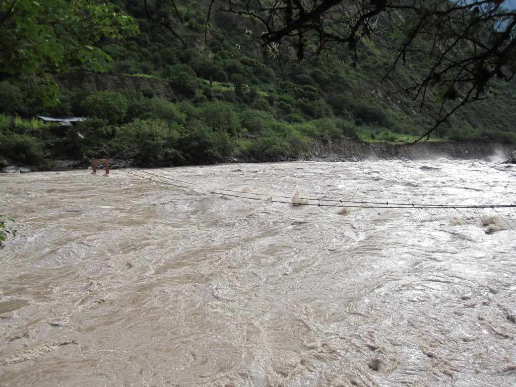
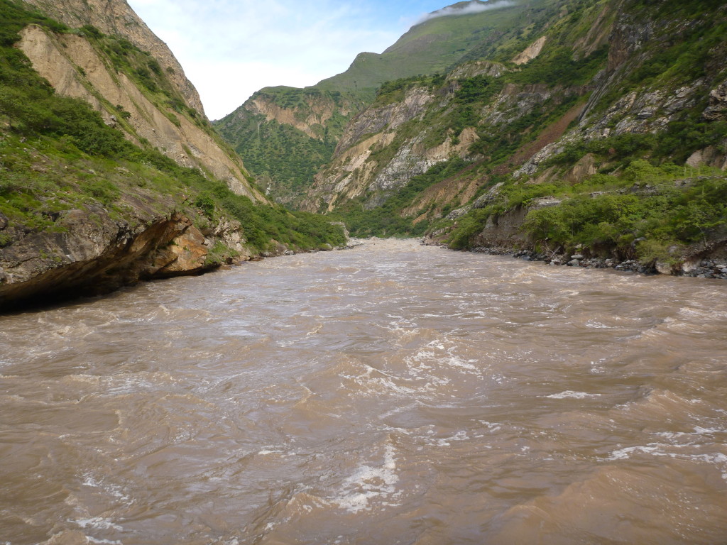
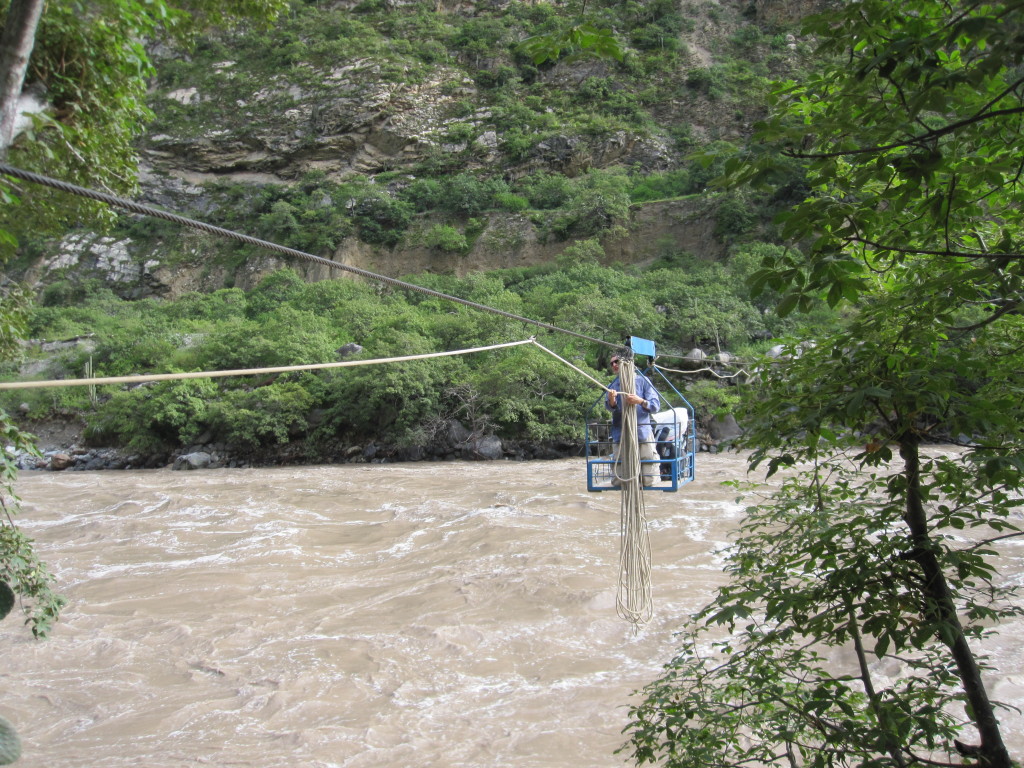
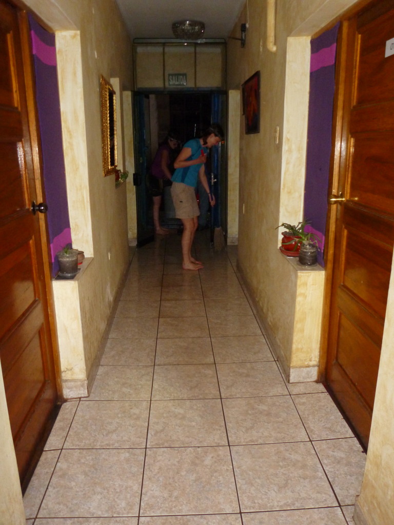
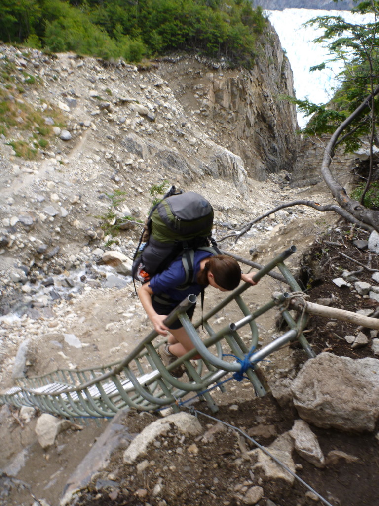
To get to Choquequirao, we had to cross a fairly large river. Upon approach, we could see that the bridge across was completely submerged. Even the handrails were under water. Instead of the bridge, we took a cable car across. Nothing new for Jeff, as they have these in the Cascades, but a new experience for me. Kind of terrifying and awesome as you hang over a roaring river pulling yourself across (which was hard for this weak-armed girl).
There’s our bridge. You can barely see the hand rails.
View upstream from the cable car
Jeff in the cable car
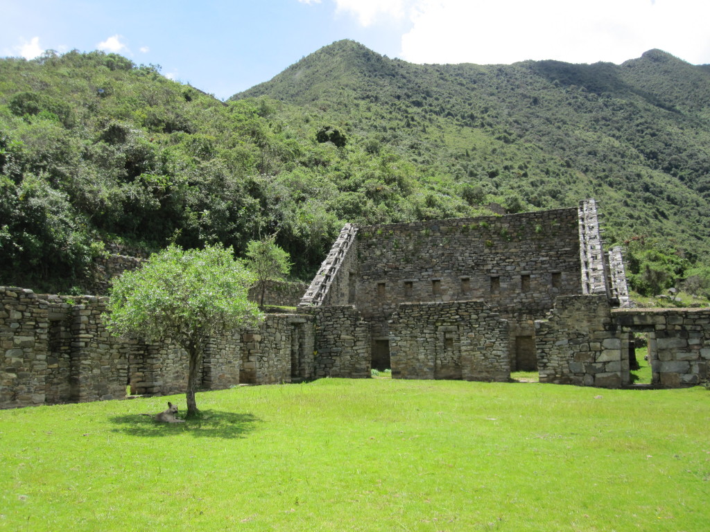
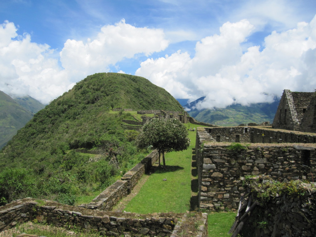
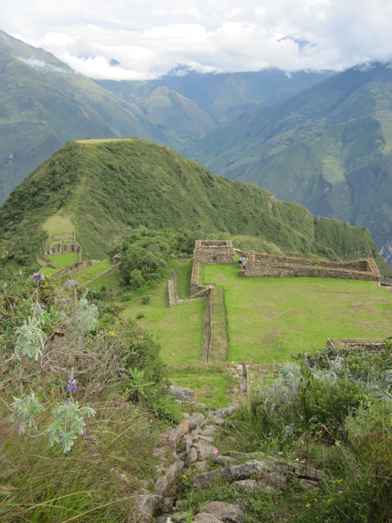
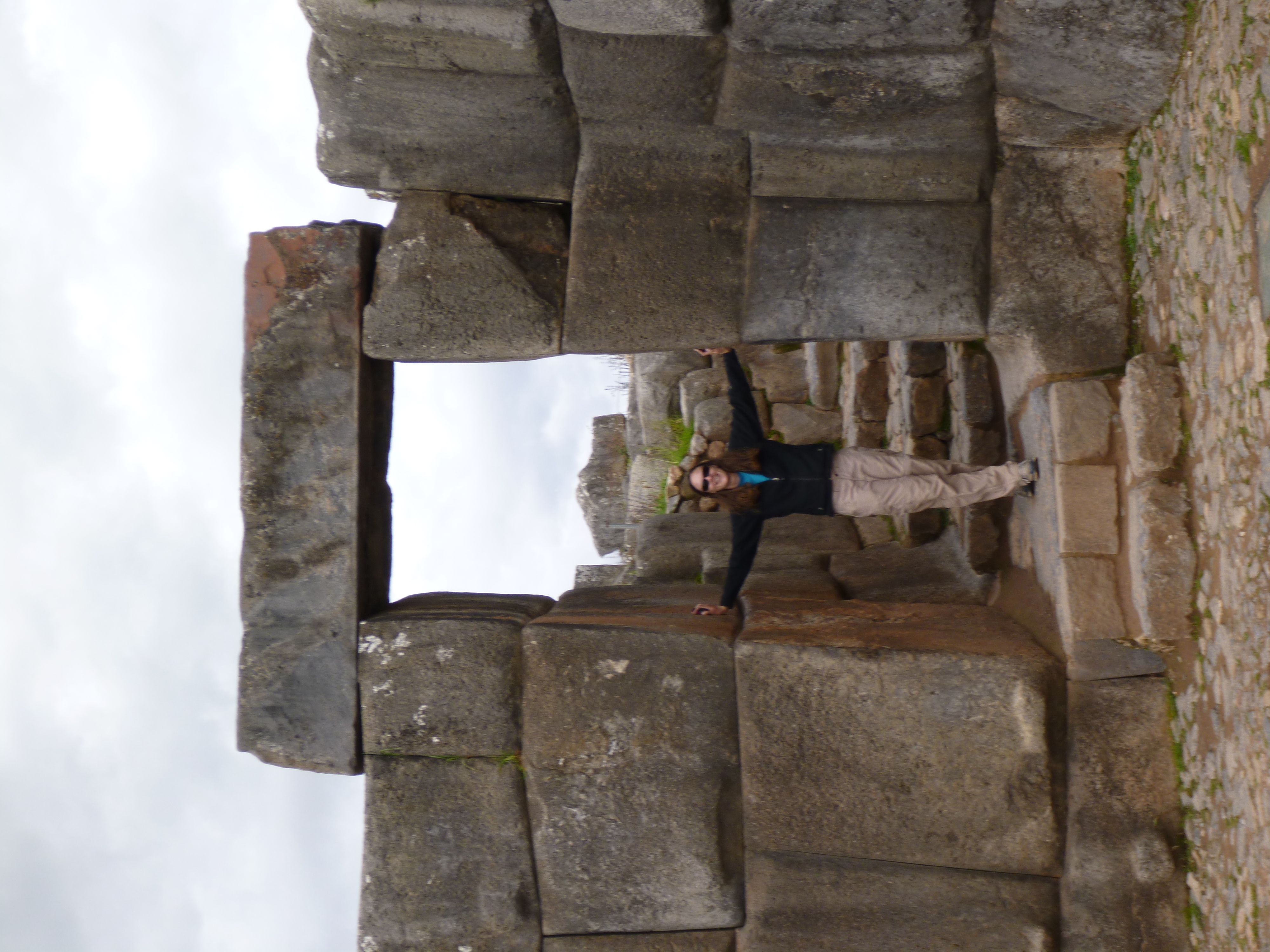
We had the ruins of Choquequirao all to ourselves, with just two rangers to keep us company and make sure we didn’t do anything too bad. Apparently hanging our wet tent on the walls was okay though. The ruins were interesting. I’ve heard that they are considered the second best site after Machu Picchu. Though much smaller and with less impressive stonework, they were still very impressive, and maybe more fun since we weren’t sharing them with hundreds of other tourists. This site is known particularly for the llamas which are worked into some of the terrace walls in white stone. It was a bit of a hike down to them and also gave us more perspective on just how big and steep their terraces were. To get back to our trail, the rangers told us to climb up the water channel that once brought water into the site. Definitely would not have been allowed at Machu Picchu. We heard rumors about a proposed gondola into Choquequirao from a town across the valley with road access; if put in, it would really change the experience of the site.
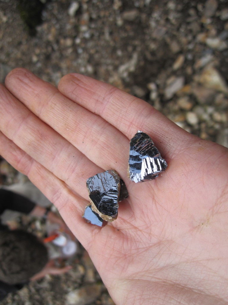
Near the top of the 14k pass, we walked through a mine tailing. I convinced Jeff to stop so we could look for interesting rocks. We quickly found that there were galena deposits here, and spent a while trying to find heavy rocks that might contain galena. Jeff got really into it, and it was hard to pull him away or convince him that we didn’t need to bring every rock home. He still probably ended up carrying ten pounds of rocks for the rest of the trip.
Mine tailings
Galena
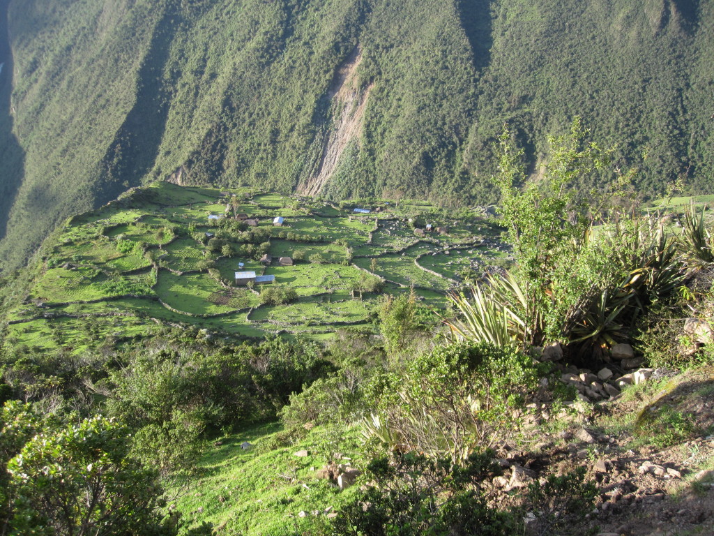
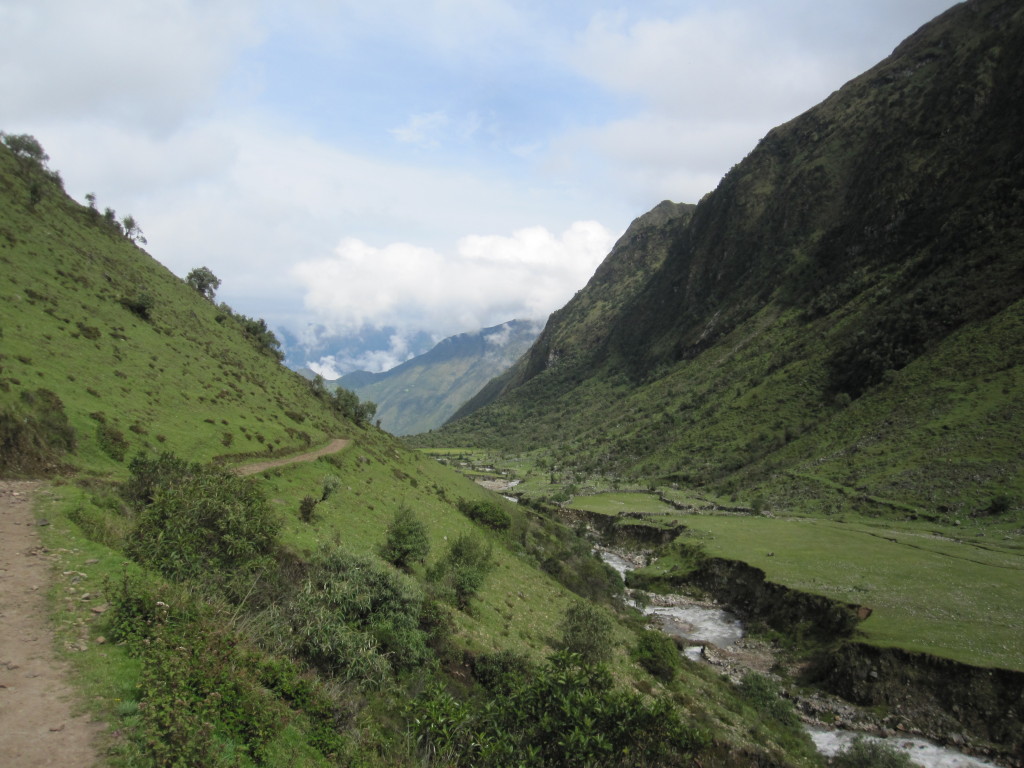
In the valley after this pass, we reached a town called Yanama. Set in a stunningly beautiful place with mountain, valley, and river views, it was a very traditional community and lifestyle with maybe around 30 families. There are no roads into Yanama, though we discovered on our way out the next day that they are putting one in which will no doubt change the town completely. We stayed the night in the yard of a family on the outskirts of town. We also bought some dinner from them (which is likely where there food poisoning came from) and they invited us into their hut. It was interesting to see something of the way they live, cooking on wood fires and with guinea pigs (a local delicacy) running around under foot. A simple but hard life, though they seemed to have enough.
View from the pass at 14,000′
Yanama from above
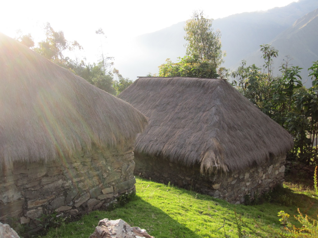
Typical huts
Where’s the trail go?
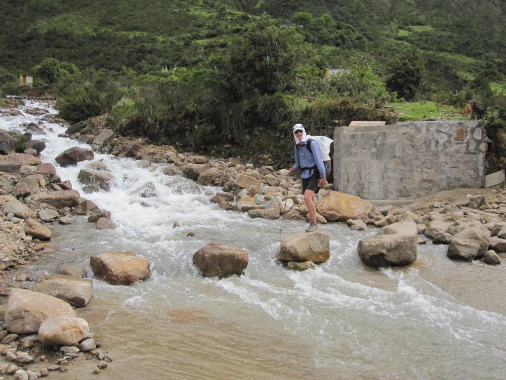
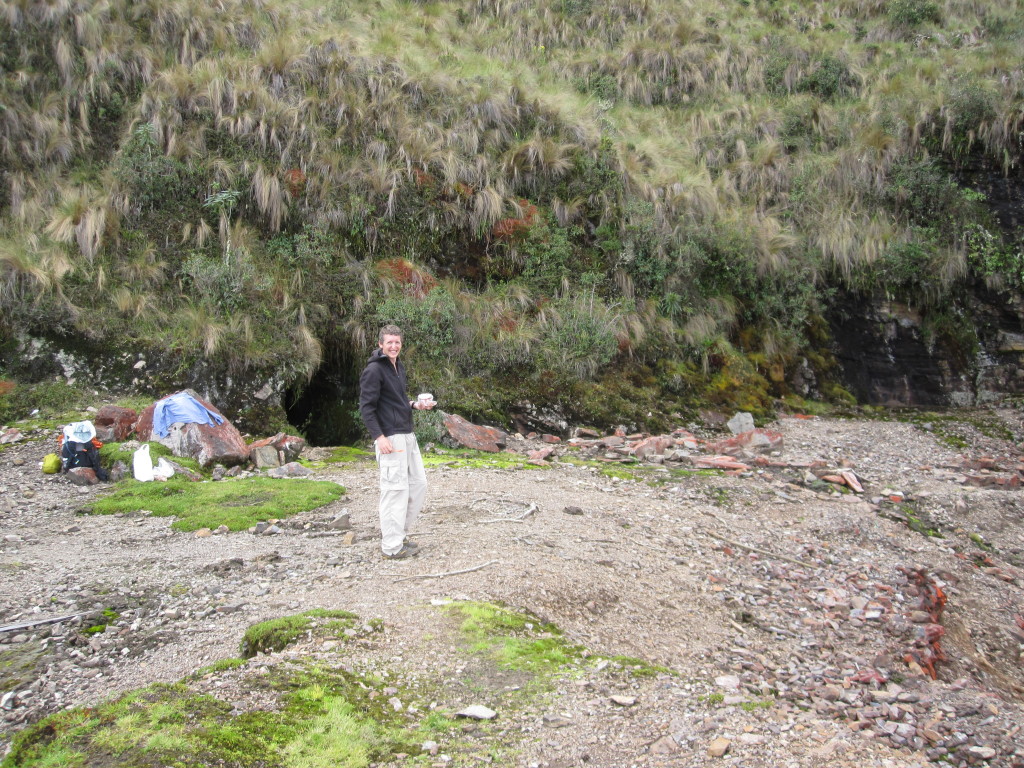
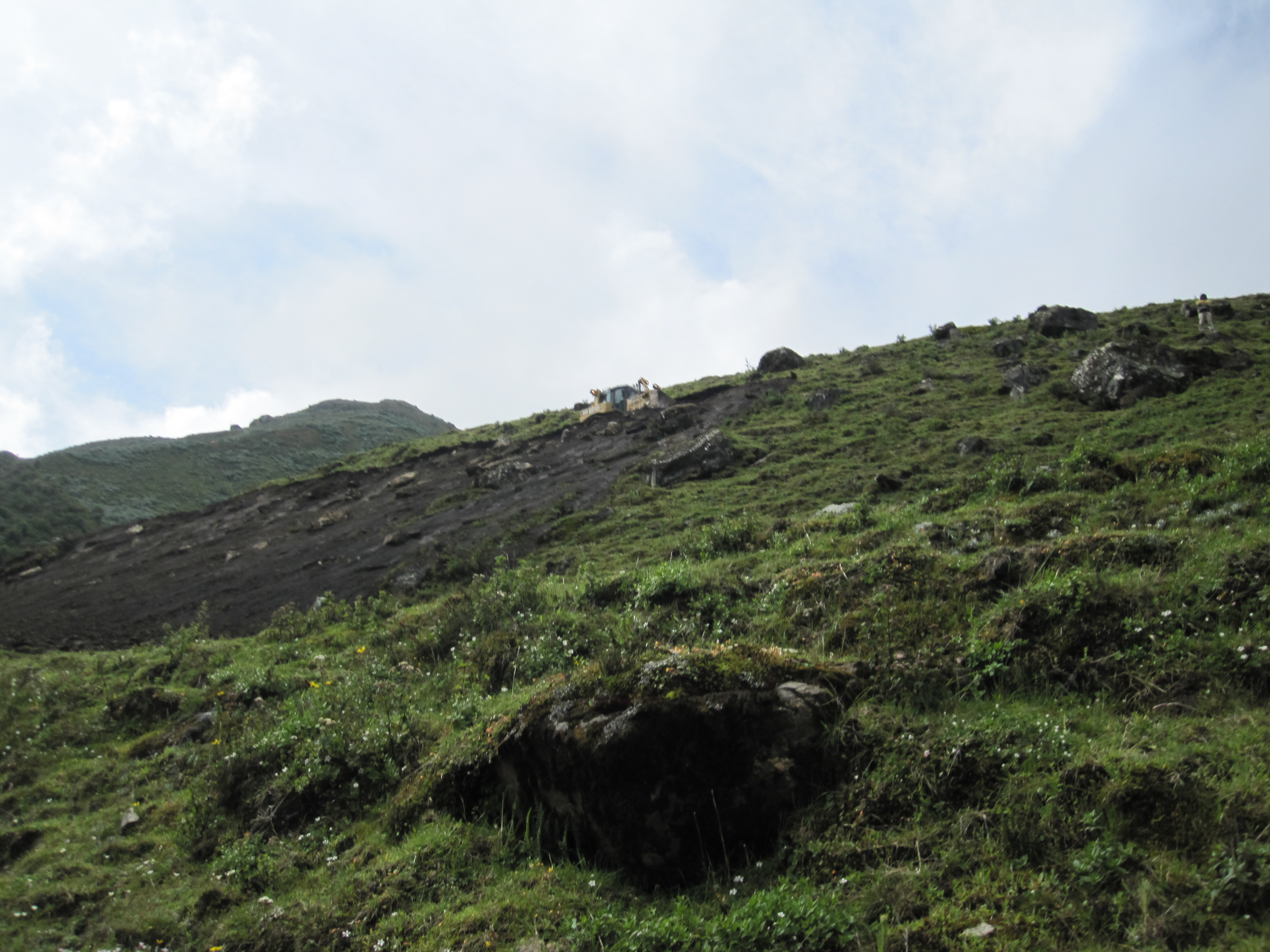
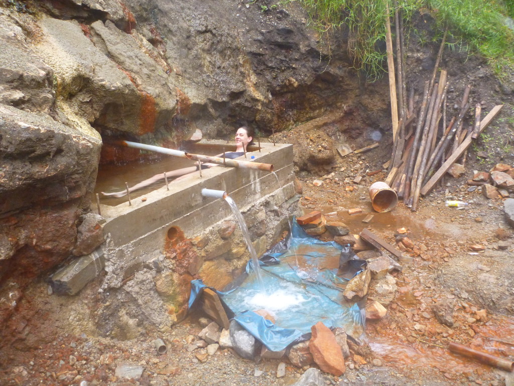
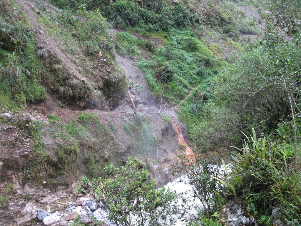
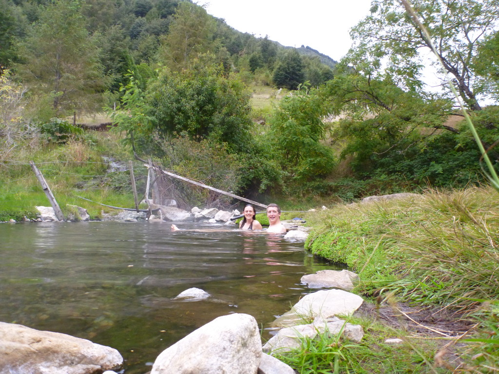
The next day we made our way out of Yanama and encountered the bulldozer that is making a road into town. Such a strange sight. We made our way over the highest pass partially on the new road (which was often covered in rock slides) and partially on the old paths. Once down a ways from the pass, we were picked up for the last hour or so of our hike by a passing dump truck and dropped off at the town of Ccolapampa. We’re still not sure how he got the truck as far in as he did but were grateful for the ride. At Ccolapampa, we were hoping to find a hot springs to ease our muscles. It took a while to find though, as the first several people we asked told us it did not exist. When we finally found it, helped by some locals, we found that they are putting in a very nice pool area (clearly for tourists) that is not yet complete – probably what people thought we were looking for. What we used was a small concrete bath put in by locals at the natural hot springs above a roaring river. The path down was steep and sketchy.
View back toward Yanama
View up toward the next pass
Bulldozing a new road
The trail goes up to the saddle on the left at 15,500′ elevation
At the pass. The highest we have ever hiked: 15,500′
The new hot springs pool being constructed
The old concrete tub, used by locals for bathing and tired hikers for soaking
The hot spring pool was directly above a steep drop to a rushing river. You can just see the tub in the middle.
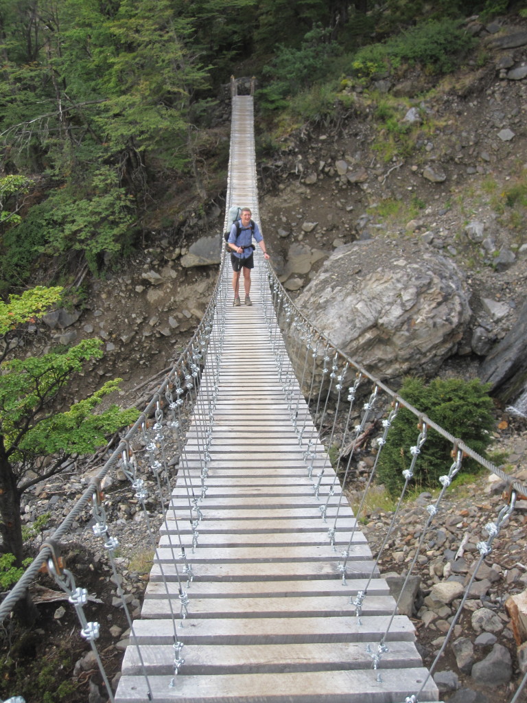
From Ccolopampa, we followed the road for a while before turning off on a path up and over our last ridge toward Machu Picchu. At the top of the ridge was another small ruins site and a great view out toward MP. A large waterfall came pouring out of the rocks on the other side about halfway down, created by a hydroelectric company. At the bottom of the valley we reached the hydroelectric station and mine where we were hoping to catch a train to Aguas Calientes, the town at the base of MP that is only reachable by foot or train. We were too late for the train, so had to walk another two hours along the tracks into town. It was an hour from dark at this point and our flashlights were almost completely out of batteries, so we were happy to find some batteries at the train station and trudged our way into town exhausted but excited by the idea of a shower, bed, and good food.
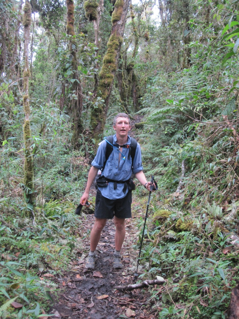
The ‘cloud forest’ at our last pass that our guide book was so excited about. Turns out it looks just like the Pacific NW!
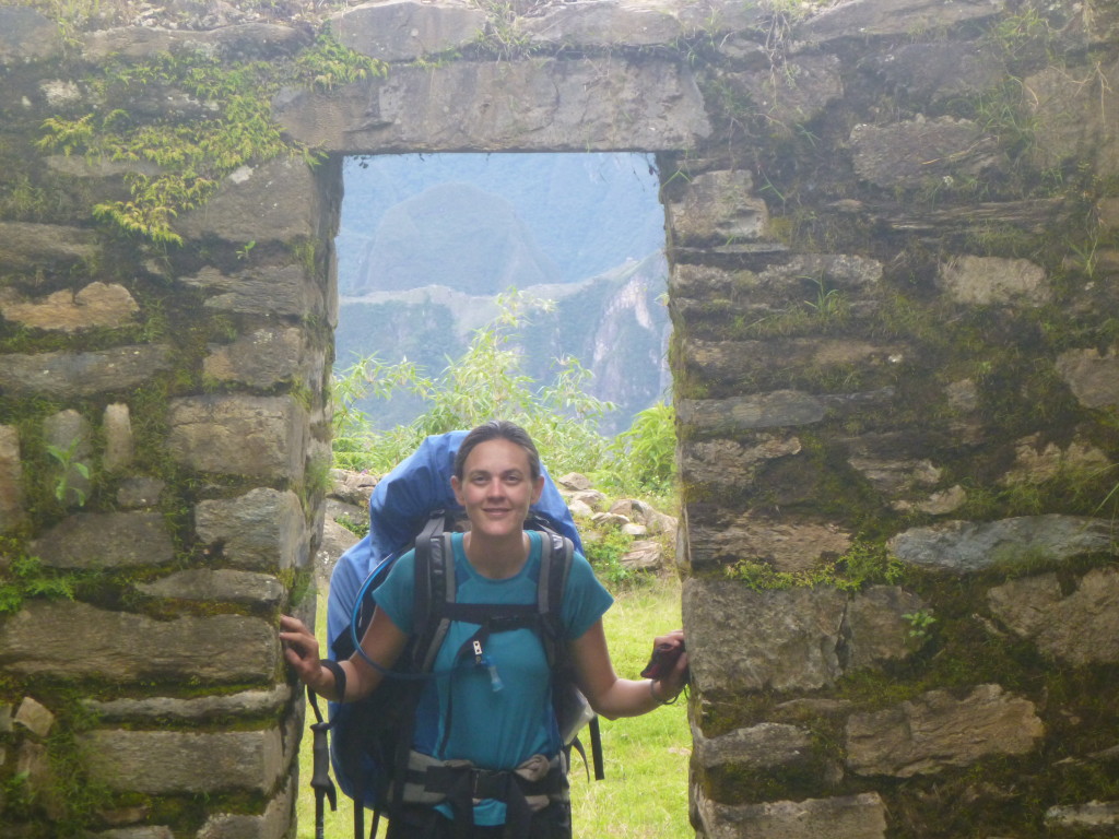
Our first view of Machu Picchu. Just above my head.
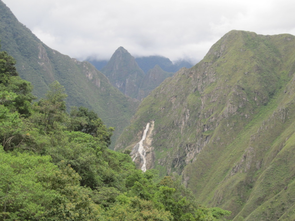
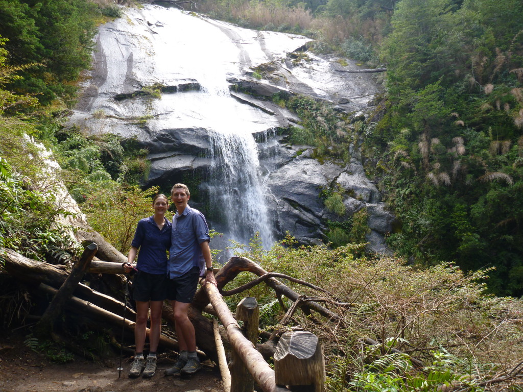
Waterfall above the hydroelectric station. It pours out of the middle of the mountain.
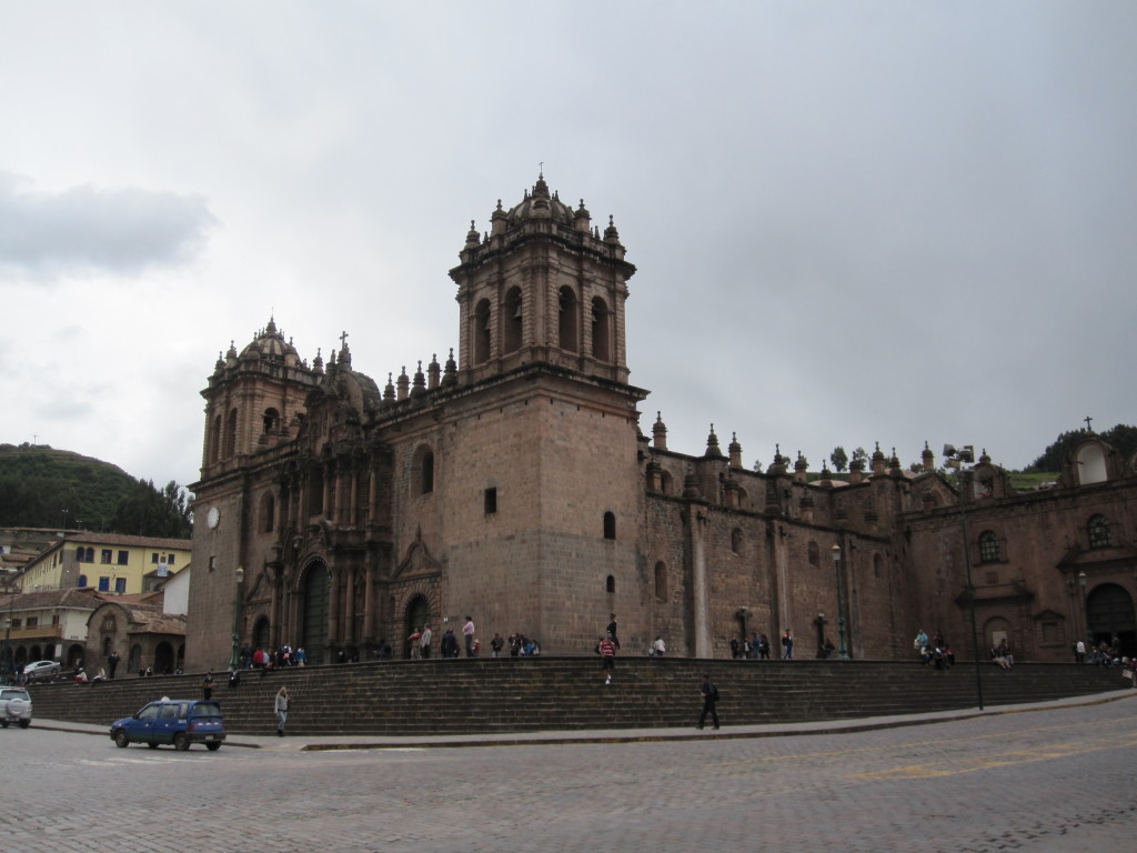
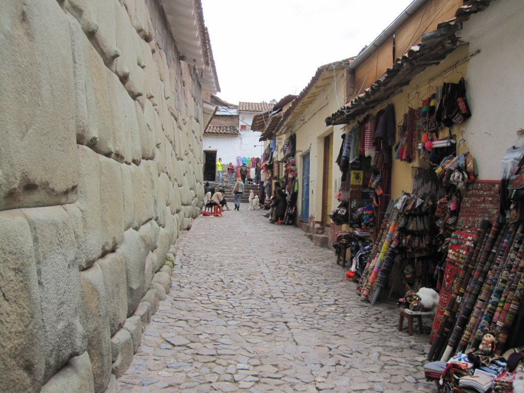
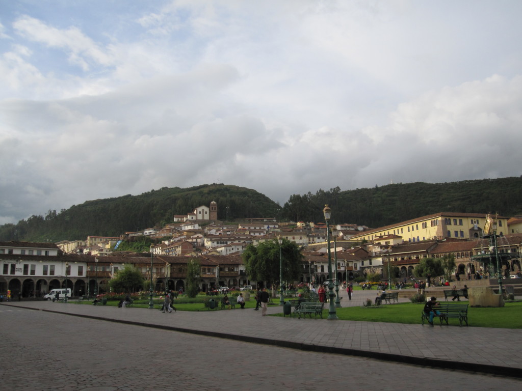
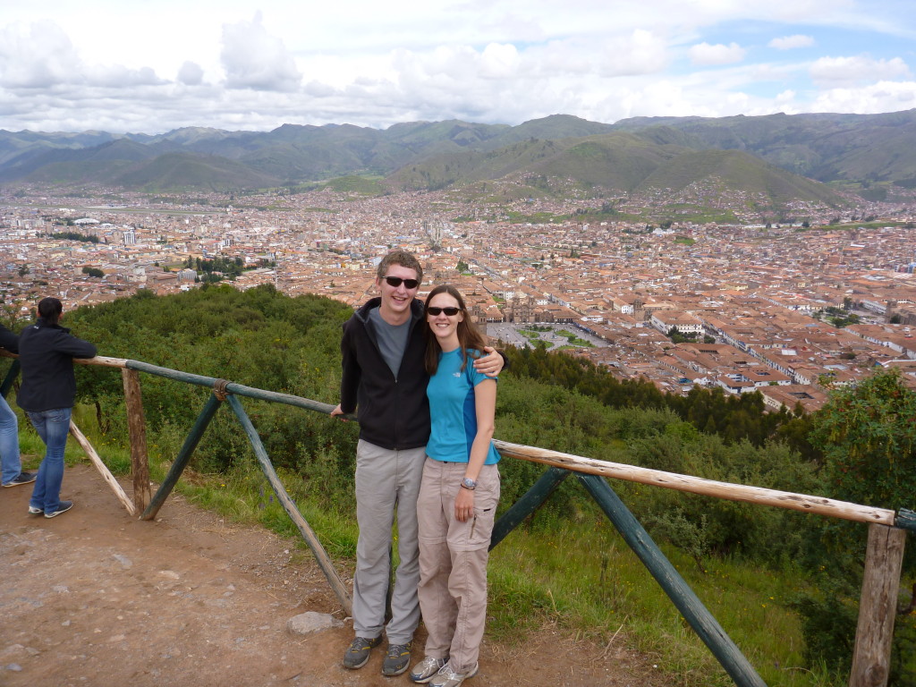
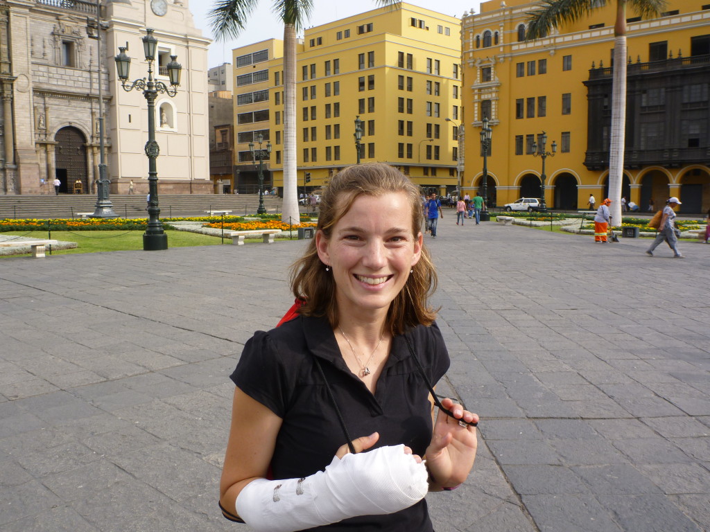
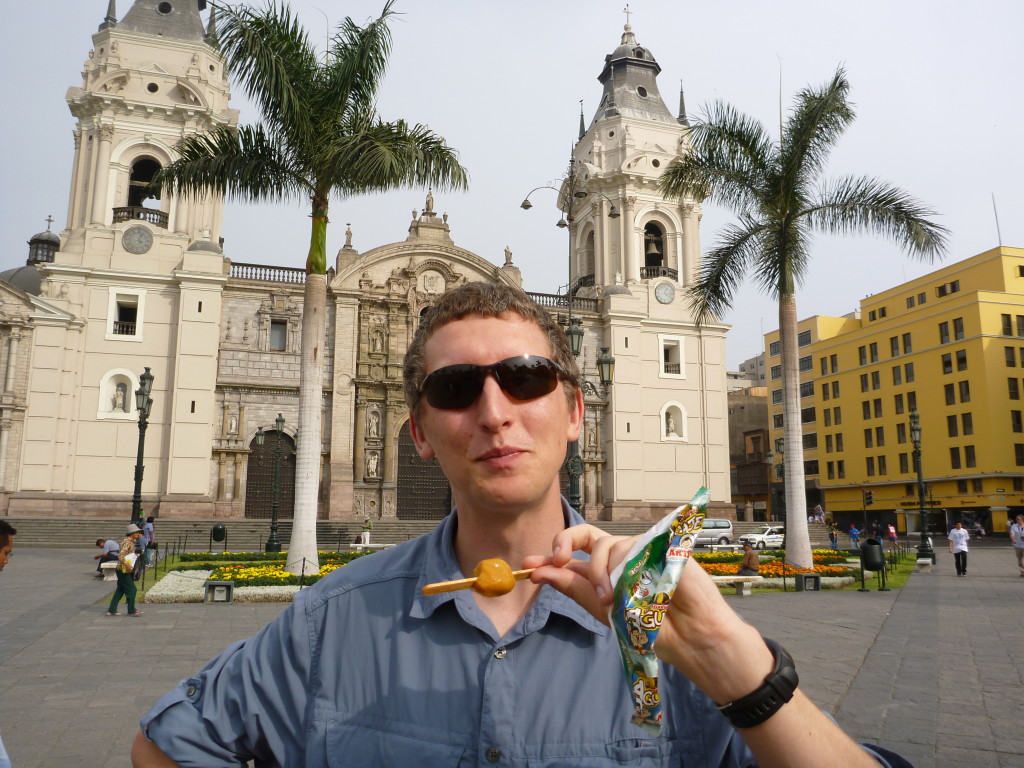
Cusco sits at about 11,000 feet altitude, and is therefore a good place to acclimatize before hiking in the Andes. We had planned to spend 2 nights in Cusco before heading out on our trek, but we did not acclimate as quickly or well as we expected. Instead, we spent 4 nights in town and did a lot of shopping, walking around, and exploring the sites. Cusco has several old colonial Spanish churches and beautiful squares and hills.
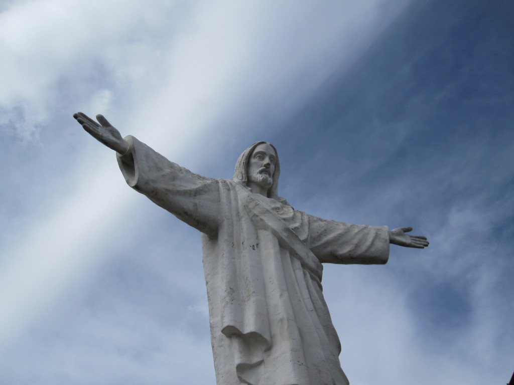
This Jesus statue sits on the hills above Cusco, much like the more famous statue in Rio
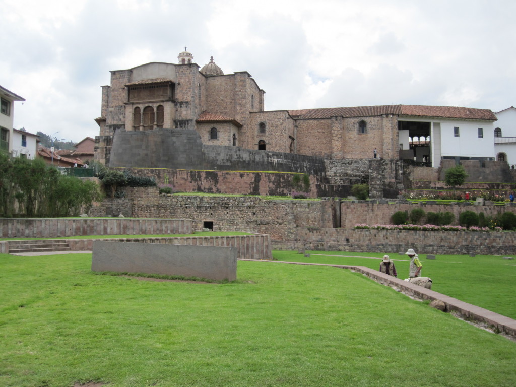
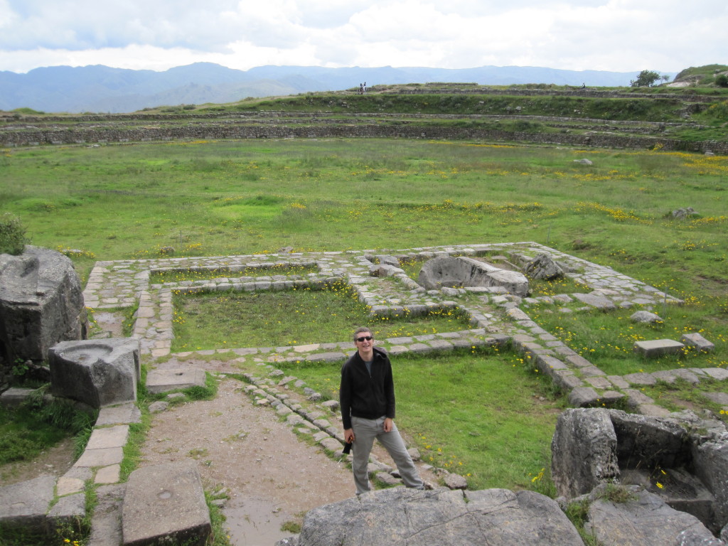
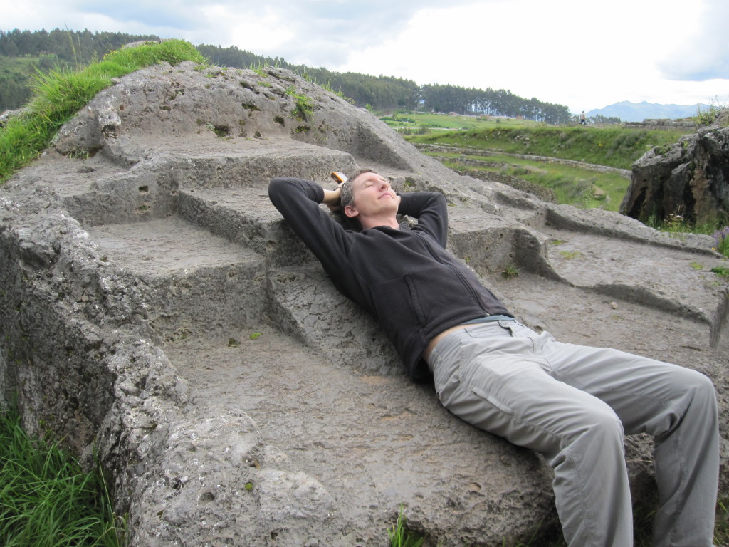
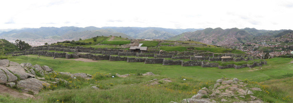
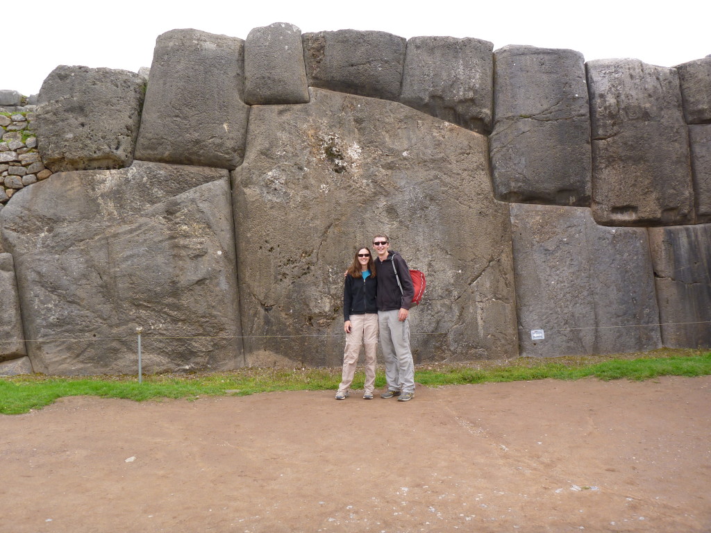
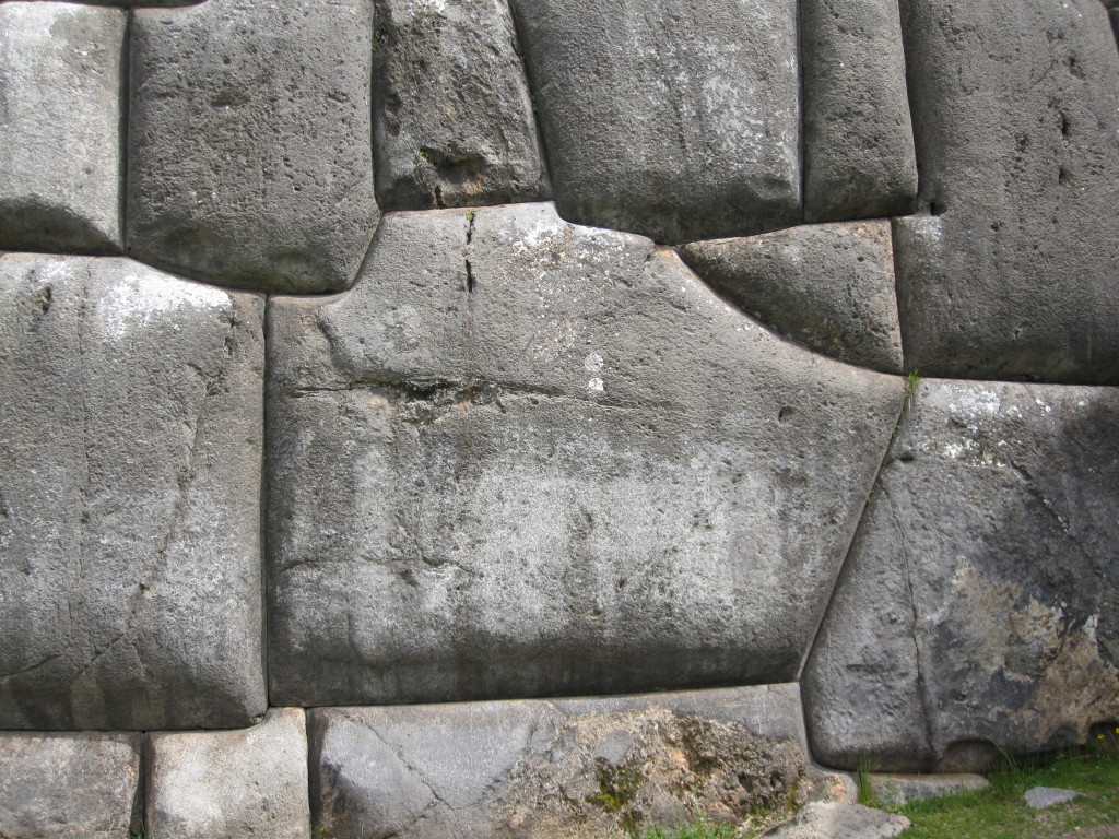
The Inca site Sacsaywaman lies above the town not far from where we stayed. Through the site has been looted for building material ever since the Spanish conquest, there remain interesting ruins and a very impressive wall with some of the best stonework we saw the whole trip. Huge stones were brought in by slaves (I’m not sure how) and form the base of the walls. There are actually three walls that run parallel to each other in a sawtooth terraced formation. Apparently the original Incas who built Cusco set up the city in the shape of a puma, and the walls of Sacsaywaman are the puma’s teeth. The entrance to these ruins was steep (literally and financially) but worth it.
The Puma’s teeth
Look at that stonework and such large stones!
The city of Cusco spread out beneath us
No mortar. Hand cut stones fit perfectly together
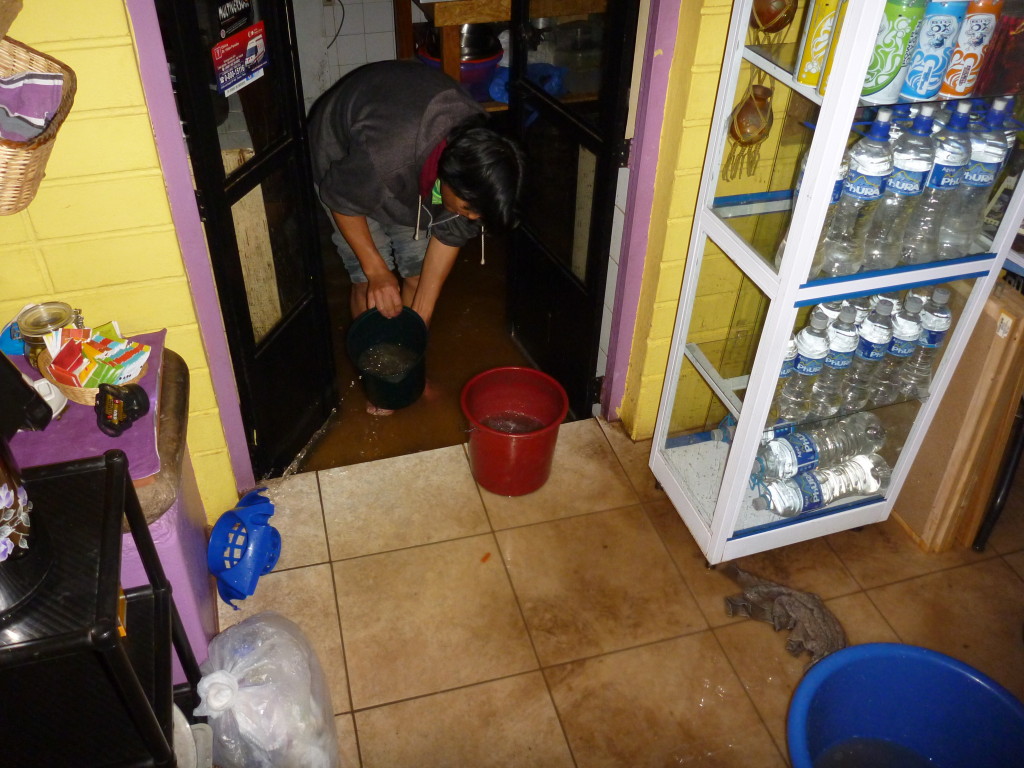
One of our last evenings in Cusco added an extra adventure to our time. During heavy rains one evening, a pipe got blocked somewhere down from our hostal and the place began to flood with sewer water. Absolutely disgusting. We helped set up a fireman line for bailing out the kitchen and main room and bailed out our own bathroom to keep it from spreading to our room. Did I mention this was disgusting? Thankfully none of our stuff got wet.
Usually, we would tend to skip the big cities, but I have a good college friend who now lives in Lima. Erin and her husband Pepe lead missions trips through Peru and are awesome people. We met up with them for a couple of days and they introduced us to a Peruvian favorite dish – roasted chicken and fries. Much better than our roasted chicken at home, and sort of a healthier equivalent to fast food.
Erin also took us downtown so we could see the square and tour a very interesting church. It was an old Franciscan church with impressive artwork, architecture, and catacombs. She also introduced us to a few unusual jungle fruits.
While in Lima, we also enjoyed checking out the Inca market and buying fun souvenirs. Jeff is perfecting his haggling skills.
Erin!
A jungle-fruit flavored popsicle and Lima’s main square
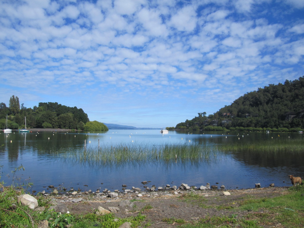
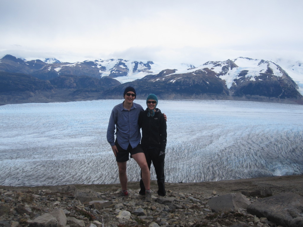
To recover from backpacking in Torres del Paine, we spent a few days in Chile’s lake district in Pucon. A definite tourist town with a special emphasis toward adventure sports. We arrived late one evening in the pouring rain and went searching for a campground. We were thoroughly exhausted and frustrated with each other by the time we got the tent set up. But we were greeted by a beautiful morning:
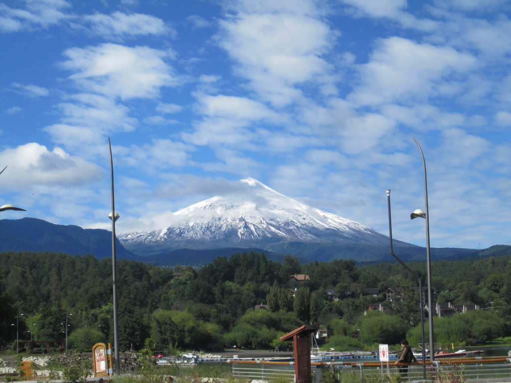
Volcan Villarca
Pucon is known for hot springs and for being close to Volcan Villarca, a fairly easily climbable active volcano. We thought about climbing it, but iffy weather and the cost of tour groups you had to join to do it deterred us and we instead went out on an impromptu backpacking trip in Huerquehue national park.
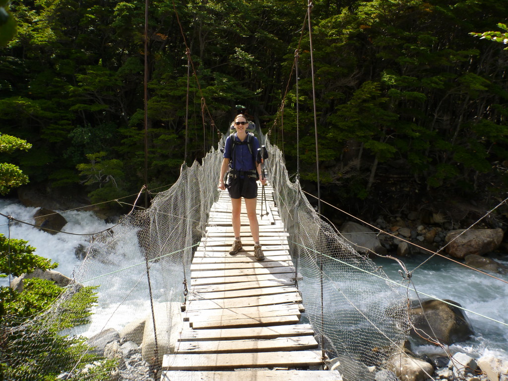
Totally different vegetation and scenery than southern Chile. This area was heavily forested and clearly quite wet. We did a 2 day out and back trip through the hills to a natural hot springs. Longish days through forest and by many beautiful lakes. Not too many views, but still pretty. The hot springs were wonderful. So refreshing and secluded; we had the baths almost to ourselves and decided we should do more trekking to hot springs in the future. The way back was less fun as it rained all day. The rain was fine for a few hours, but once I was completely wet, backpacking became much less fun. I’m learning to hike in rain but am still definitely a fair weather camper!
Never have I been to a park with so many annoying rules.
Nor have I ever been to a park where the rules are so little enforced.
I think we broke every rule the park had. And no one cared.
A few examples:
Trails have closing times.
What?! Apparently they don’t want inexperienced people on the trails after dark. We obey this rule for about a day, until we see others break it with impunity. I have a feeling that we never again obeyed that rule. Jeff and I prefer (okay mostly Jeff) to get up late and hike later in the day. Many days we didn’t get on the trail until 2. We developed a bit of a reputation among our fellow backpackers. One day we started on a section of trail probably several hours after its closing time and were approached by a ranger as we started. I figured for sure he’d make us turn around, but after talking to him for a minute, he waved us on. Clearly the rangers don’t care too much about their rules either.
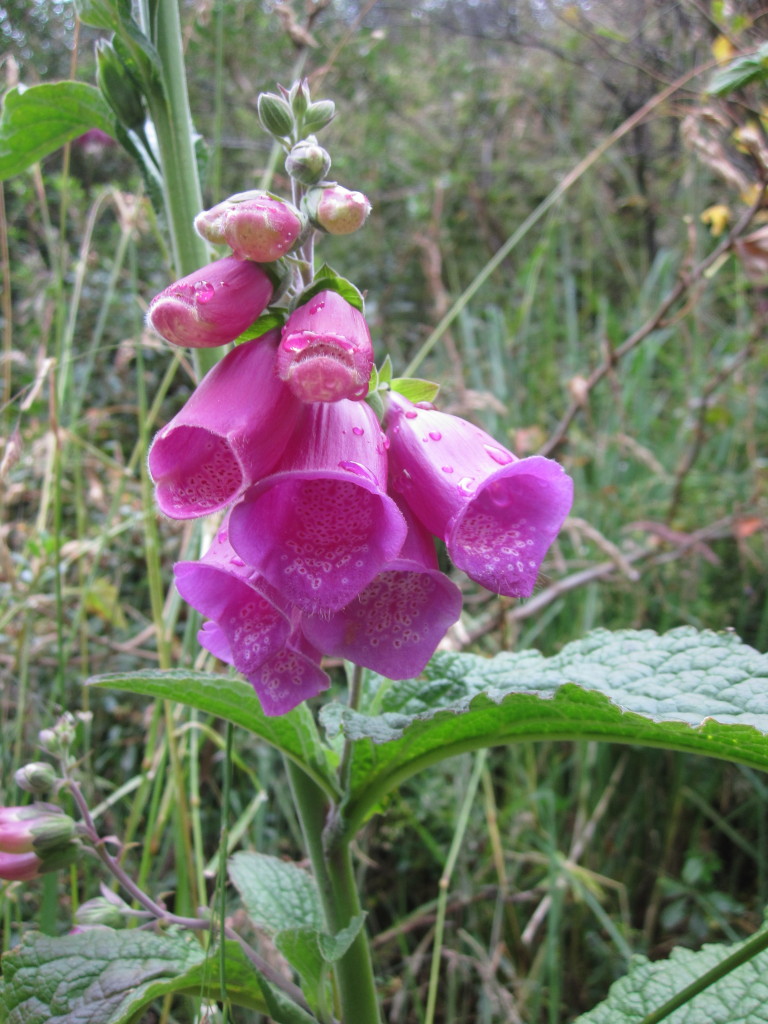
(I don’t have a picture for this one, so here’s a pretty flower)
Camp only in designated camping areas.
Okay, I understand this one. Given that there are at least 40 – 200 backpackers on each section of trail every day, if camping anywhere were allowed, the park would be destroyed. Still annoying. Nearly all designated camping areas are privately run and cost anywhere from $8 to $16 per person per night. Talk about expensive back country camping! We only broke this one once. On a section of trail with a ridiculous span between viable campgrounds. We later discovered that the closed campground we would have preferred to camp in actually accepts campers if you arrive late enough. Probably to avoid what we did. Oops.
Never hike off trail.
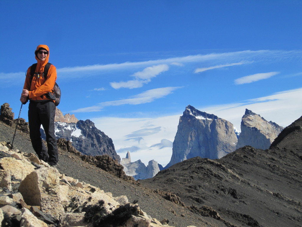
Anyone who knows us well will understand how hard it is for Jeff and I to obey this one, as we love to hike cross country. We did a good job until the last day, when we had an extra day and decided to see if we could climb a peak near the towers. I was nervous about being caught all day (Jeff is better about breaking rules than I am), but we had an awesome hike and saw the best views we had all trip. We also saw some deer that we later discovered are very endangered.
Other thoughts:
We came away with a renewed appreciation for the maintenance of American trails. Chile’s CONAF did a ridiculously poor job of maintaining sections of the trail, ultimately creating more work for themselves in the future as the trails get torn up.
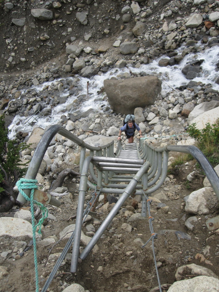
Really hope those ropes hold!
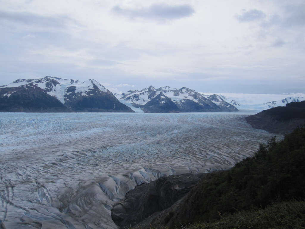
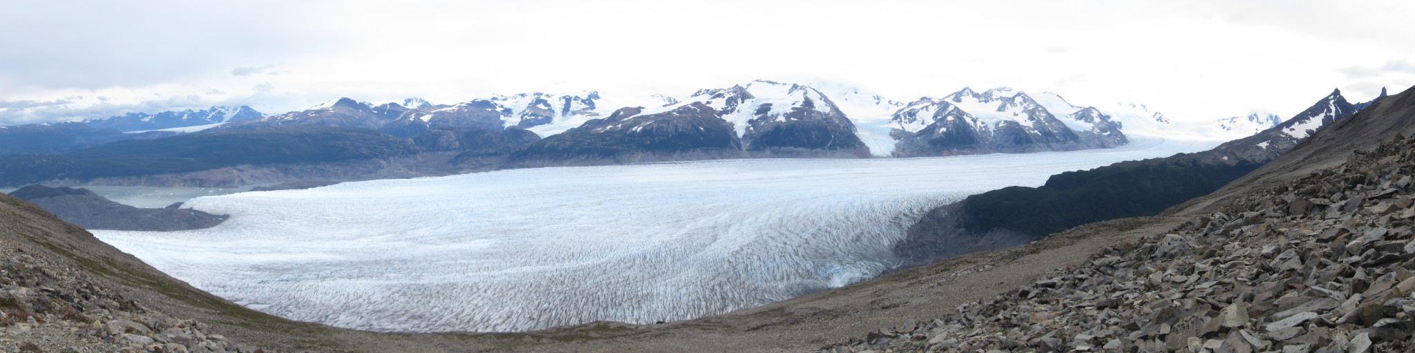
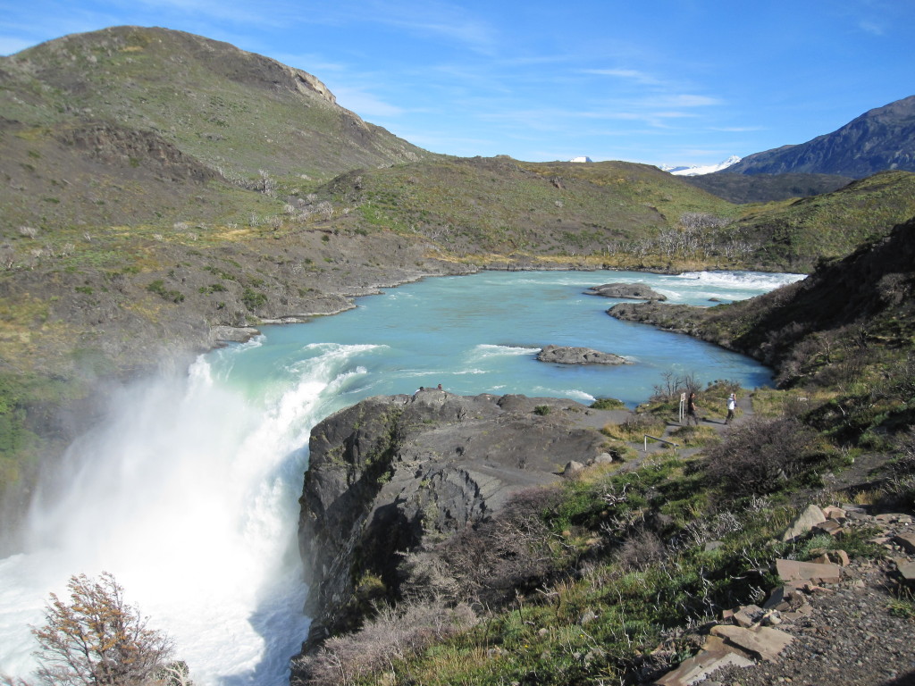
There are two main backpacking options in the park – the ‘W’ and the ‘O’ (also known as the circuit). We chose to do the ‘O’, which is the ‘W’ plus the backside of the park. The W section was awesome and well worth doing. The rest of the O, however, was not worth the extra time with one exception – the Grey Glacier as viewed from the pass was great.
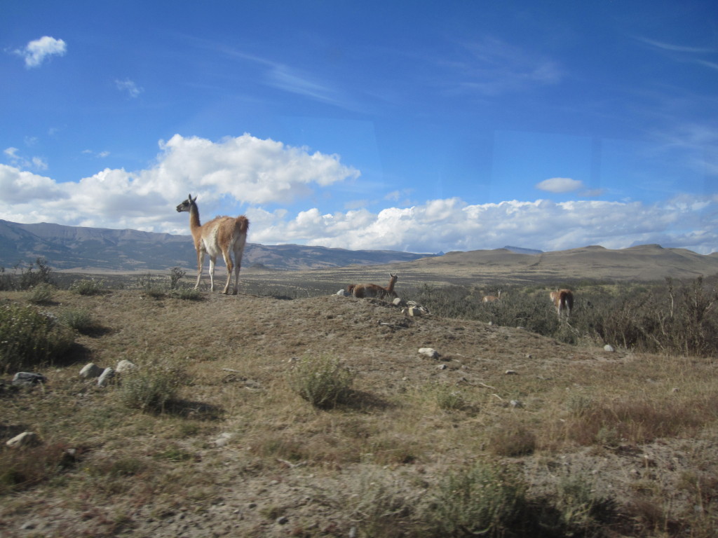
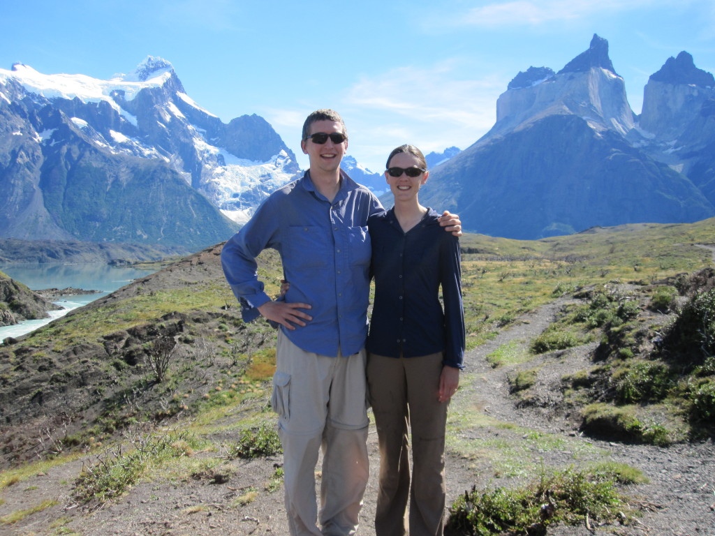
Our first stop in Jeff and Kristen’s great adventure was to Torres del Paine national park in Chile. After quick stops in the very windy and cold Punta Arenas and the tourist heavy (but much more charming) Puerto Natales, we made our way by bus into the park. Guanacos and nandu (llama and ostrich-like respectively) made appearances on our way in.
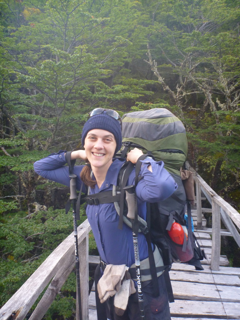
We started up into the park with all our gear + food for 11 days. All that food makes for awfully heavy packs.
Our goal was to complete the ‘O’ circuit around the park, and we had enough food to spend an extra couple days doing it. Our first several days were iffy on weather, with rain through two of the first five days and nasty mosquitoes for a couple days. We got lucky with the rain, though, and got it on the best possible days.
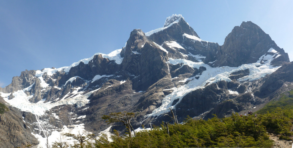
Most of the back portion of the trip was underwhelming until we came over the highest pass to an overlook of Glacier Grey spread out beneath us. Wow!
Glacier Grey
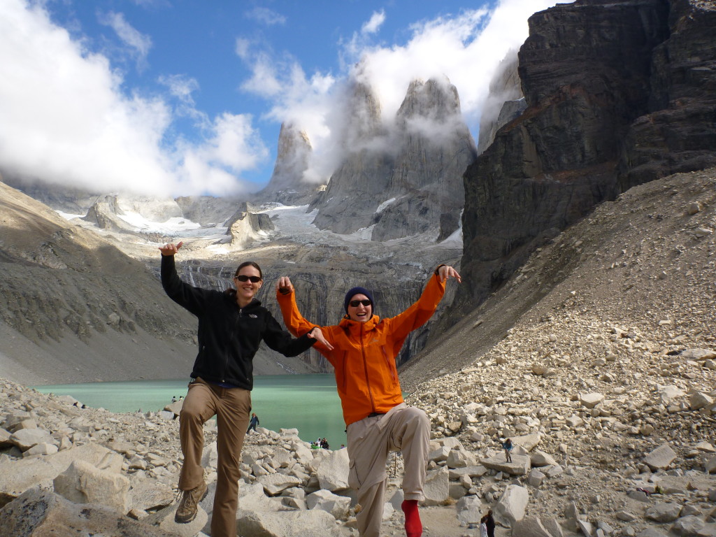
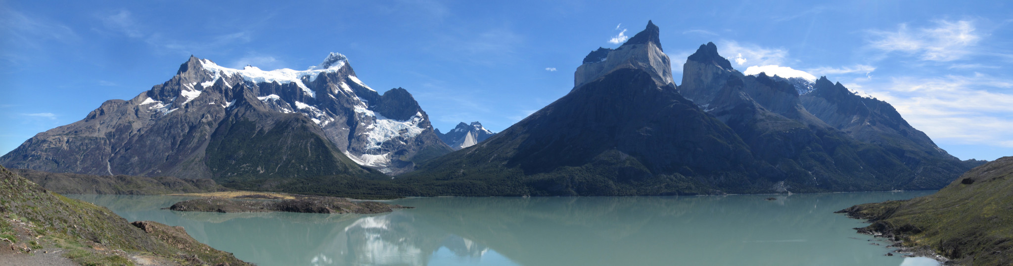
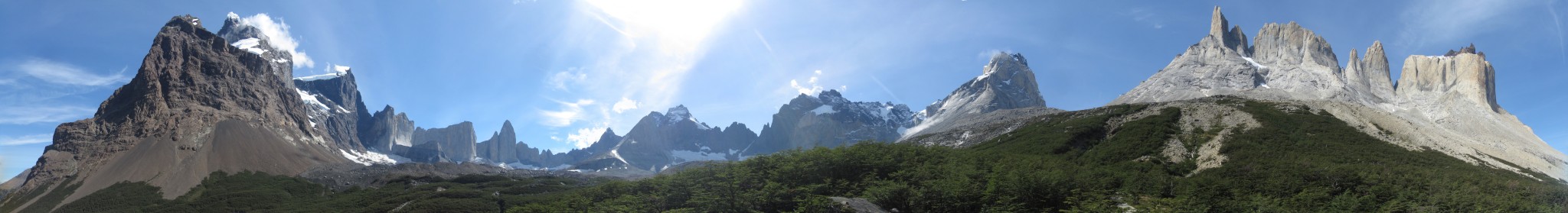
The front portion of the trek, known as the ‘W’, was much more spectacular. Particular favorites were the view of the cirque and of Paine Grande’s glaciers in the Valle del Frances and the towers from which the park derives its name in the second valley. Watching the alpen glow build on the towers at sunrise was beautiful (and a departure from our usual 10am wake up time).
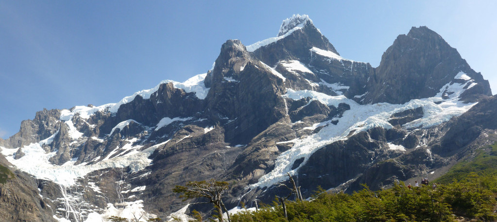
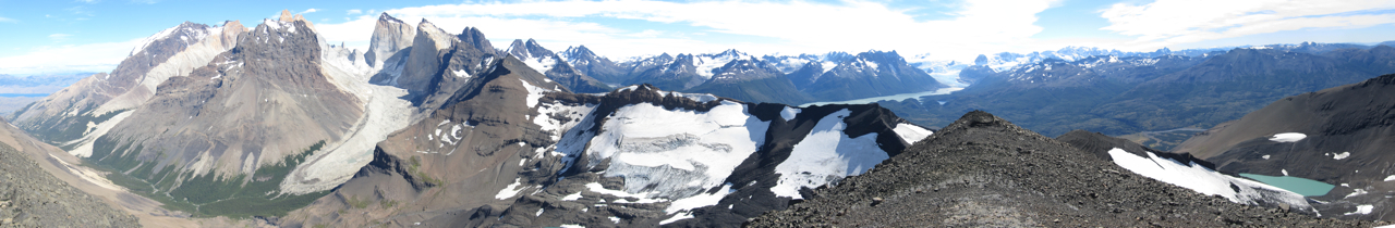
Valle del Frances Panorama (click to expand)
Paine Grande
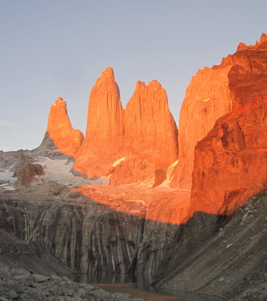
Torres del Paine
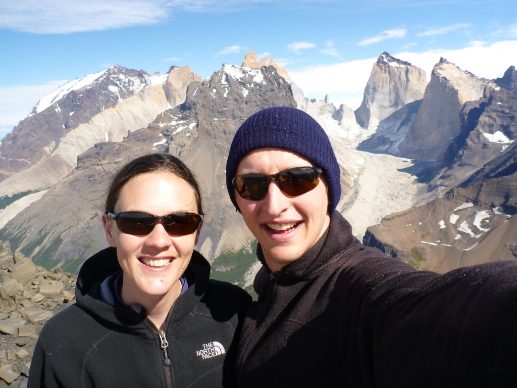
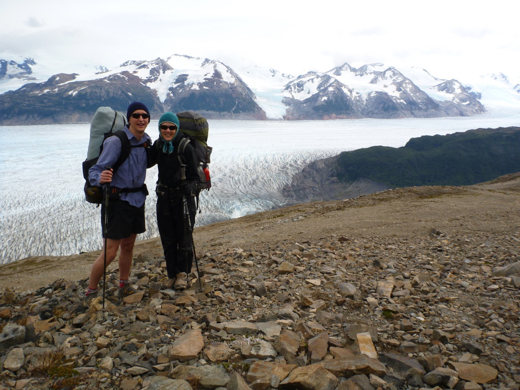
Our biggest highlight was something very few people get to experience. Mostly because it is technically not allowed. There may be a later post about annoying park rules, but one of them was to always stay on trail. With one day left to spend in the park and nowhere else on trail we really wanted to go, Jeff suggested we make our way off trail and up a nearby peak. Excellent decision, as we got the most spectacular views we would see with panoramic views back behind the back section of the park to heavily glaciated peaks.
Click to expand
On our final day, we took the bus further into the park to a short hike to a classic viewpoint of the ‘horns’ and of a waterfall. We were short on time, so I ran up to the viewpoint for a few pictures.
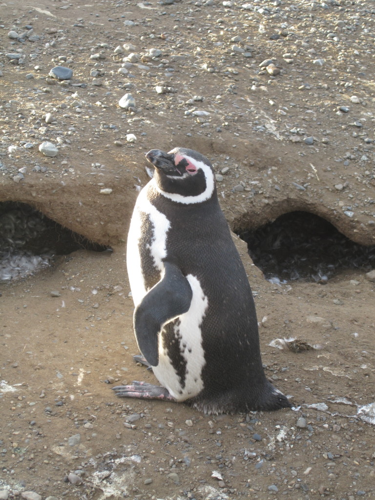
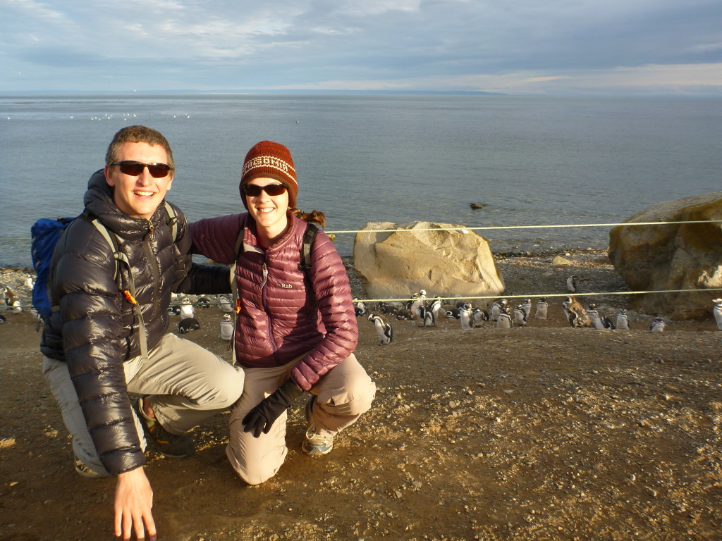
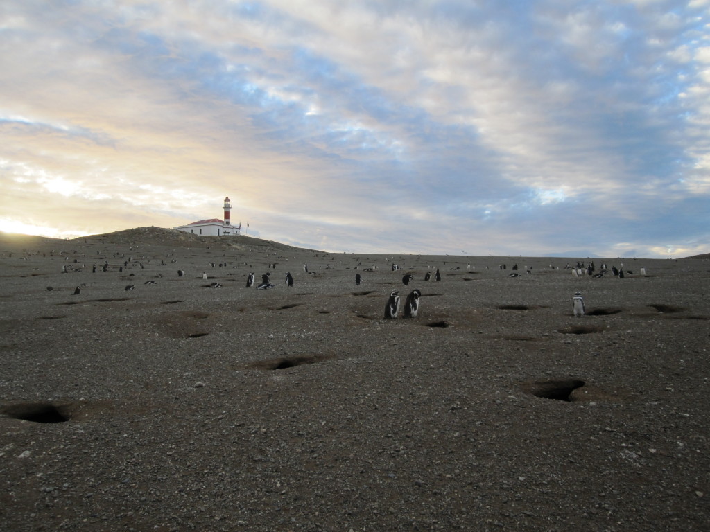
On our way back through Punta Arenas we took a ferry tour out (with all the other tourists) to see nesting penguins at Isla Magdalena. So cute. Just like the movies, actually.
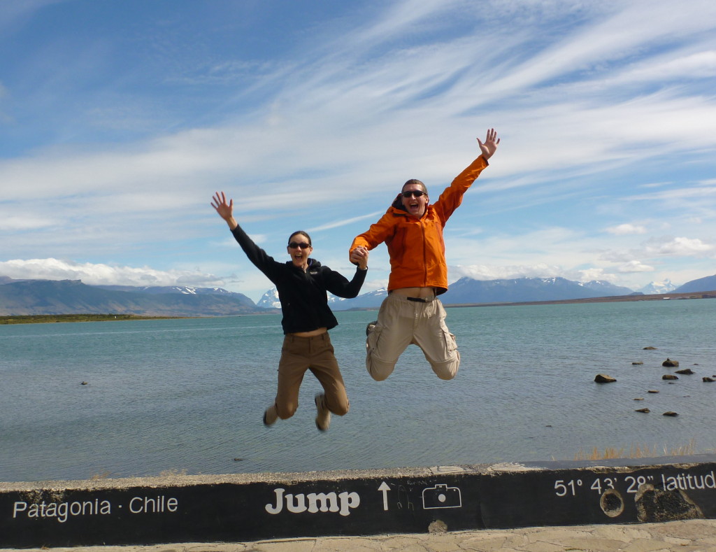
Jeff and I returned from 2 months of adventuring around the world recently. I wrote up some notes on the trip while we were gone that I thought had been lost when our tablet died mid-trip. Thankfully, I was able to resurrect the posts I had written last week. As I update them and add pictures, I will add them to this site. Enjoy!